Just four of us for this walk but very enjoyable nonetheless. The day was dry, clear but very cold, especially when there was a wind. But not too bad as long as we kept moving.
 |
| This one came in at 6.88 miles on my GPS so we'll round that up to 7. A good mixture of urban, woodland, riverside and open moorland, with a few steep bits to exercise our lungs as well as our legs. We started and ended at Okehampton Station, which had a cafe at the end! Hooray. We dropped down into Castle Park and walked through the town, passed the College and then up the East Okement River, as it flows through West Cleave. A fair way up, we headed up and around East Hill before dropping back to the station. A good walk and a good day to choose, as it poured with rain the next day. |
 |
| An interesting twisted oak in Castle Park, opposite the eponymous castle. Someone has gone to a lot of trouble constructing a spiral of stones on the ground underneath. |
 |
| A couple of old water pumps on display at the roadside opposite what remains of the Okehampton Workhouse. My sort of street art. |
 |
| 'OBB 1935'. Okehampton Borough Boundary marker, of which there were 11 originally, but not all of them remain. |
 |
| This Robin was disappointed when there were no crumbs falling from our coffee stop. One of the very few small birds we saw on the walk. |
 |
| Looking back down the East Okement River, with the take-off point on the right for the Old Town Leat. This runs for the better part of a mile and once fed a couple of water mills. The last of these closed in the 1950s, but had converted to electricity long before then. Although the Victorian mill building is still standing, the site was first mentioned in the Doomsday Book. |
 |
| A rather poignant inscription on a wooden bridge over the East Okement at Fatherford. |
 |
| And here is the story behind the inscription. Before the bridge, crossing the river was by the nearby ford. Charlotte was crossing this on her horse, the horse bucked and Charlotte was thrown off and drowned. The bridge has been constructed so that it is wide enough for both walkers and horse riders. A fitting and very practical tribute to her memory. |
 |
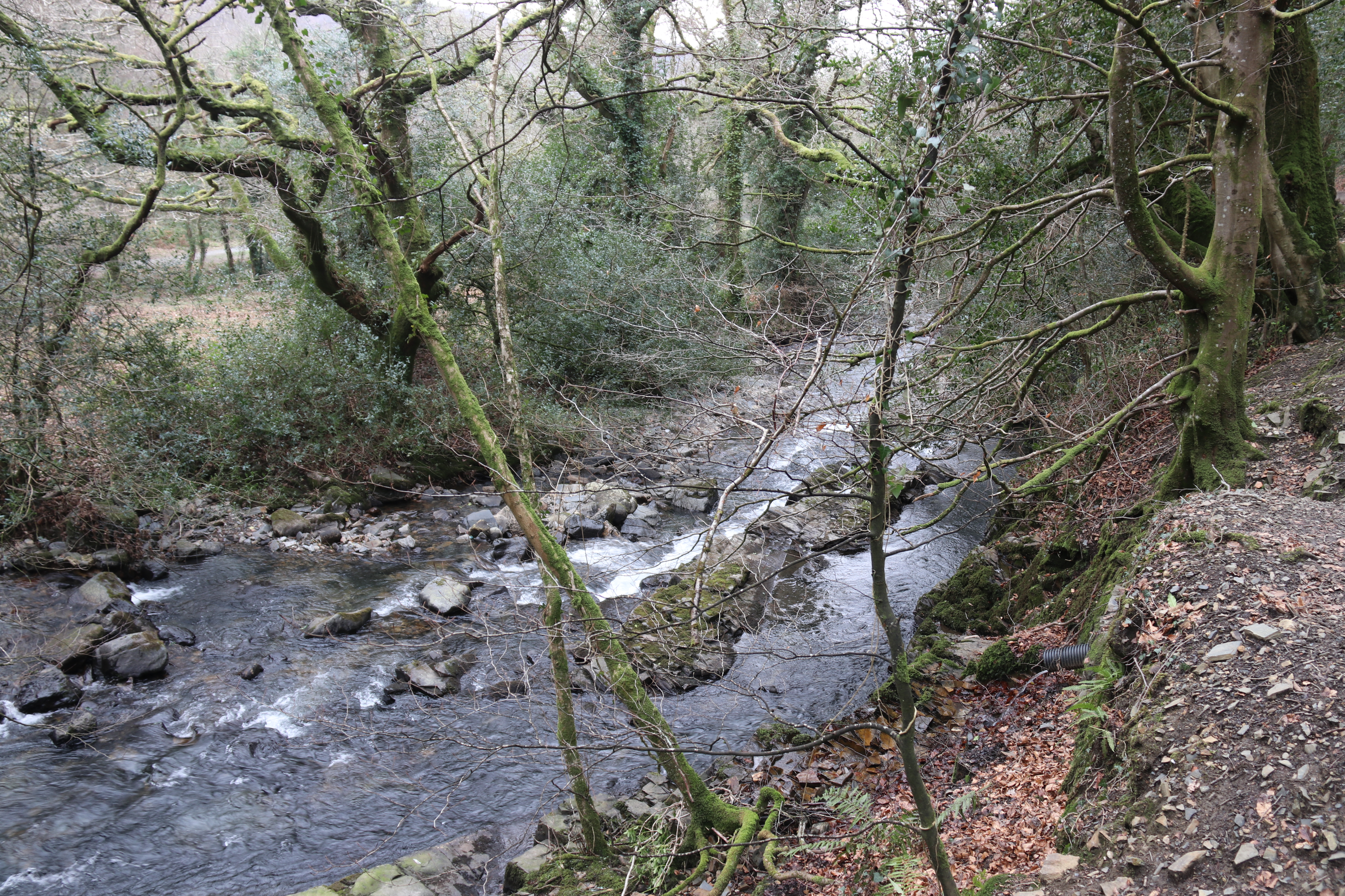
| A series of views as we progressed up the side of the East Okement. I think we were all expecting the river to be running higher than it actually was. Despite this, it was very impressive and, having walked up a considerable length of it, it loses elevation quite rapidly. |
 |
| The lane to Lower Halstock farm, with the just about discernible remnants, to the left, of the original ford through the brook. Just a little bit of forgotten history. |
 |
| An unusual lichen growing on a wall just up from the ford/bridge. Not sure what it was but my naturalist neighbours, Mary and Tony A, were able to shed light on the identity: "The lichen is Peltigera canina, Common
Dog Lichen (most likely - the commonest one). Supposedly named after the
canine-like tubercles on the underside. Rather variable in cuticle colour
depending on what the symbiotic co-species of alga or cyano-bacteria is
cohabiting with the fungus". It's always nice to know what you are looking at, |
 |
| There was actually some snow on the upper reaches of Yes Tor. |
 |
| Seeing ponies and horses on Dartmoor is a common occurence but this was the first time I've seen so many and so many that were not your usual Dartmoor-type. In fact, these are Shetlands and Miniature Shetlands bred at the Lower Halstock stud farm. |
 |
Descending from the higher slopes of East Hill, we came across these earthworks associated with 'settlement' on the OS map. Here's a little more information:
The rampart on East Hill stands 3 metres high in places and has a wide, flat-bottomed, ditch on the outside. East Hill is properly termed a promontory fort, rather than a hill fort, having been built at the end of the East Hill ridge to take advantage of the natural defences provided on two sides by the steep wooded slopes above the East Okement River and the Moor Brook.
East Hill Iron Age fort lies on moorland south east of Okehampton and can be approached from a number of directions using public rights of way.
Hill forts are characteristic of the middle and later Iron Age (500BC – AD 50) and are seen to be the fortified settlements of the Celtic people. At least 12 hill forts survive on Dartmoor. East Hill fort is at grid reference SX 604 941.
Records show that East Hill fort was examined by the Reverend H G Fothergill in 1840. One hundred years later John Brailsford undertook a very small-scale excavation on the central entrance which divides the rampart in two. He found that the end of the rampart was neatly faced with eleven courses of small slabs and there appeared to be a palisaded trench forming a passage into the entrance. No other finds were recorded. A nearby outcrop of rock is known locally as ‘Roman Chair’. This name possibly arises from the 19th century discovery of a horde of 200 Roman coins in the East Hill Area. |
 |
| The footpath taking us back to the Fatherford Bridge was, in parts, quite vertiginous. The sides of the West Cleave, through which the East Okement runs, are surprisingly steep. |
 |
| Another one for Mary and Tony A and the response was: "The
plastic "biscuit wrappers" are a proprietary item used for surveying
for Hazel Dormice. Ecological surveyors plaster an area with them as a quick
and dirty way of finding out if there are any HD in an area/site. The HD
frequently build temporary nests in them, so the surveyors visit them for
several months at weekly intervals". |
 |
| A more traditional box used for the same purpose as the plastic version. Once you get your eye in for these, it was surprising how many there were. |
 |
| A closer view of the Peltigera canina, showing, if you look closely, the tubercles at the 'leaf' edges that look like dog's teeth. |
And for those, like me, who find the sound of running water so calming and evocative.


No comments:
Post a Comment