Monday 28 September 2020

Sunday Stroll on Dartmoor

We had a change of scenery and moor for our last Sunday stroll. We took advantage of already being in the Plymouth area and headed for Norsworthy Bridge, at the top of Burrator, and walked from there onto Dartmoor. The weather was just the job - sunny, dry and clear. A walk with tors, open moor, archaeology, industrial archaeology and some social history at the end. All that and a couple of homemade pasties (mini-size, of course).
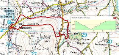
We clocked just under 3.5 miles for this one. Short, perhaps, but with enough uphill to make us feel that we'd had some exercise. We started and ended in the car park at Norsworthy Bridge. We headed off to Down Tor, took in the nearby stone row, then across to Combshead Tor, down into the valley via Cuckoo Rock and back to the start along the old farm track.
Many tree around here are bedecked with the lichen Old Man's Beard or Usnea Florida/Floridiana. A testament to the unpolluted air in these parts. It looks very similar to the epiphytic flowering plant known as Spanish Moss (which is neither a moss nor a lichen!)
On the way up to Down Tor and looking back towards Burrator. Autumn is definitely with us with leaves and bracken turning brown.
Down Tor, our first target.

Very close to Down Tor is this Bronze Age complex of stone row, cairn circle and standing stone. It is also known as Hingston Down stone row. Down is a mutation of the old word for hill 'dun'. Hingston might be derived from a name - Hengest has been suggested. Put them together and you get 'Hengest's Hill'. Does this suggest who was buried here or hereabouts? Who knows but it's always interesting to speculate.
The stone row is about 300 metres long and has 174 stones which vary in height from 0.2 to 1 metre. Something like this, if  it was built to commemorate a person, says something about the status of the person. There is some evidence for alignment of the sun at certain times of the year.
Looking down from Combshead Tor in a south westerly direction. On the horizon, the silver strip is the sea. The landscape has been shaped by humans for millennia and this view contains some typical elements - Bronze Age hut circles and cairns, signs of tin mining stretching back to mediaeval times and farming artifacts spanning centuries.
There are many abandoned farms on Dartmoor and in this valley, Dean Coombe, we came across two. The first one is Coombe Head farm. It was not abandoned as such but bought out when Burrator reservoir was built in the late 1800s/early 1900s. Although it is about 1 mile from the actual reservoir, it lies within its water catchment area and all agricultural activity was prohibited because of possible pollution.
The remains of mushroom stones at Coombe Head Farm. The stones originally had flat tops and supported a barn or grainstore. The overhang of the flat tops prevented grain eating rodents getting at the precious food.
We came from the right, headed off to the left and left the middle direction for another day. Actually, we have walked that way several times: the track leads up to Sheepstor via quite a slog. Not pleasant in the pouring rain, as it was when we last did it.
Just a dead tree glistening in the afternoon sun.
This chunk of granite has always intrigued me. Look closely at the edges of the flat top and you'll see the drill marks used for splitting a piece off the top. The explanation I favour for this is that a gate post was split off from the top of the original boulder. Whatever came off would have been the result of a lot of hard work. Drilling granite manually does not come easy.
A rather fine old granite barn at Middleworth Farm.
I knew what this was as soon as I saw it. People lighting campfires in and around the moor seems to be a particular problem this year and this was obviously an attempt to reseed one such spot.
And this was confirmed by this notice lying some way away. I've got no problems with people lighting well controlled fires in appropriate areas but I do have big problems with those who do it indiscriminately and without any regard to the surroundings. Unfortunately the Covid crisis seems to have brought out the worse in a lot of people. Oh dear, I do sound like a grumpy old man. But, then, I am.

Thursday 24 September 2020

Richard's Ramblers stride out again

It's been a long time and we finally went on a walk with one of our walking groups - Richard's Ramblers - after we had checked that the 'Rule of Six' did not apply to such gatherings. As the border was still open, we ventured into Devon for a circular walk centred on Lydford. As the weather forecast was pretty awful, I decided not to take my camera and relied on the one on my aged Blackberry. In the event, the weather was a lot better than anticipated and, the further we got, the more protective layers were removed.
Our route started and ended in the car park in Lydford, conveniently located across the road from the Castle Inn. Both convenient for parking and for the post-walk refreshments. The walk, clocked at 7.2 miles, took us along part of the Saxon Way and the Granite Trail, along some ancient green lanes and a little bit of Dartmoor.
It seems ages since we walked in the rain along tracks that doubled up as stream beds. A refreshing change. It was odd walking without my usual camera and the Blackberry camera was no substitute. As a result the photographic record for this walk is pathetic.
Yes, it was as damp as it looks. But everything stops when it's time for morning tea and coffee.
I really understand when people want to try living off the grid and being secluded but this AirBnB is something else. Just alongside the Granite Way Cycle Trail, it's convenient for cyclists  and that's about all. The facilities, such as they are, are around the back in the bushes. All that for £500 a week.
Looking up towards Widgery Tor with its granite cross.  For 118 years the granite cross has stood looking over the western expanse of moor. The cross was erected by William Widgery to commemorate the Golden Jubilee of Queen Victoria in 1887. Widgery’s Cross holds three distinctions amongst the realms of Dartmoor crosses, firstly it is the only cross constructed of blocks of granite as opposed to being hewn from a single slab. Secondly it is the most visible of the crosses as it can be seen from many places on the moor. Thirdly the cross is the tallest of the all the Dartmoor granite crosses which stand outside of a cemetery. The cross stands on a tor commonly known as Brat tor and stands at an altitude of 452 metres.
The top end of Skitt's Lane. Delightfully verdant with the smell of fresh rain on vegetation.
Lydford has an extremely interesting history. It was a Saxon town sacked by the Vikings, was one of the original stannary towns and had its own mint (coins from the Lydford mint have been found in Scandanavia). This tower, cmmonly called Lydford Castle, dates from the 12th Century and was built as a jail originally. 


Monday 21 September 2020

Another Sunday afternoon and another stroll

Another Sunday and another Sunday with great weather, which means that a walk with good views is on our agenda. For this one, we went back to Bodmin Moor and tried a new route from Minions. What better way to spend an afternoon?
Our route, which turned out to be just under 4.5 miles, started and ended in the car park at Minions. For a change, we headed down the Marke Valley back towards Upton Cross and then back around Caradon Hill on the old mineral railway track. As it's our duty to support local businesses, we ended up in the Cheesewring Hotel for refreshments - it was the least we could do. It was a walk that had it all - industrial archaeology, panoramic views, footpaths and green pasture land. 
The view from our starting point, with the stack and engine house of Wheal Jenkin in the foreground. Two communication towers on Caradon Hill in the background: the TV mast to the left and the military transmitter to the right. Wheal Jenkin was the mine at the top of the Marke Valley complex. This mining complex extended down what was previously known as Caradon Coombe but took the name of one of the prominent early investors in the mines. They were at their peak between 1830 - 1880ish and were major producers of copper and tin.
A gnarled moss covered tree trunk.
A shady footpath dropping down to the Marke Valley. I suspect that, one time, this was a route used by miners walking between the mines in the valley and the workings associated with the Phoenix Mine further up on the moor.
My Risca butty in a buddle.
It's definitely a good year for Rowan berries.
Looking eastwards towards Sharpitor on the western fringe of Bodmin Moor.
It looks like a sunken  footpath and nowadays it is but it's actually a disused leat. Originally it would have taken water from the stream in the woods ahead and taken it down to a nearby farm. Water for animals? Power for a water wheel or a small mill?
Every now and again the landscape opens up and is framed by a break in the hedgerows. Here we are looking in the direction of Dartmoor.
I'm not above going along with photographic clichés. I'm not embarrassed to join the legions who have taken similar shots of dandelion heads.
This is part of the mineral railway that fed the produce from the Marke Valley mines onto the line that came down from Minions. 
The stack and engine house associated with the Shaftsbury shaft. Exploring the remains will have to wait until another day when some of the vegetation has died back and the features are more discernible. By all accounts, there is a lot to see and generally potter around.
Looking east from the 'normal' mineral track. Keen eyes will be able to pick out the towers of the churches at Linkinhorne, to the left, and South Hill, to the right.
Late afternoon sun on the surface remains of Wheal Jenkin, framing those of Wheal Phoenix in the distance.
Although without the geopolitical significance of borders elsewhere (think Mexico/USA or Isreal/Palestine), this stream forms part of the boundary between the parishes of St Ive and Linkinhorne. At one time, the formal beating of the parish bounds would have passed this way. Nowadays it's a place of isolation in what, purportedly, are some rather fine bluebells woods in season.


Sunday 13 September 2020

Just a Sunday afternoon stroll

Just another stroll on a Sunday afternoon. This time we were on the western fringes of Bodmin Moor.
The walk started and ended in the car park at Minions and the route took us to the hamlet of Henwood and then back along fields to our starting point. A beautifully clear afternoon, with wide ranging views all the way around. My GPS clocked the distance at 4.65miles, which pleased me as I was nursing an injured knee.
Heading towards Henwood along the old mineral railway. Sharpitor is in the distance. At this point, the mineral railway would have been carrying stone from the quarries deeper into Bodmin Moor. You can see the granite sleeper beds onto which the metal rail tracks would have been bolted. On some of the sleepers, the bolt holes are still visible.
Dropping down off the mineral railway towards the hamlet of Henwood. Although there were already a number of farms at Henwood it was not until the expansion of the Phoenix Mines and Cheesewring Quarries that the village became a significant settlement. With over 600 employed at Wheal Phoenix and 240 at Cheesewring quarry the need for accommodation and
services became increasingly acute. Rows of workers cottages were developed and farm outbuildings altered to provide additional accommodation.
 
Autumn is definitely with us. If proof is needed, take a look at all of the Rowan berries.
Down into a small patch of deciduous woodland.
Buried in the woodland was this building, with what looked like two tanks. I originally thought that I might be looking at an old mill but these tanks strike me as being more industrial than that. Perhaps they were associated with mining activity if some sort.
Feeding time for some calves at Knowle Farm, home of the reknowned and rather delicious Cornish Blue Cheese.
More autumnal berries, Holly this time.
Looking eastwards towards Dartmoor in the distance. Just a landscape but what a view.
The engine house of Wheal Phoenix, a tin and copper mine just outside of Minions. Very successful in its time but, as is typical of many of the mines in this area, it was not productive for very long and by the 1870s it was well passed its prime. It was last worked during WW1.
I love the sound of running water. Just a small stream coming down off the moor.


Friday 11 September 2020

Apple pressing time

The Tamar Valley is renowned for its fruit, especially apples of which there are many varieties, both the uniquely indigenous and locally grown 'national' varieties. We've got 4 trees of varying fecundity in our garden and, for the second year, we've had enough fruit to use it for juice. Although our local 'orchards' group organise a communal apple pressing day, it never quite works out that it fits with our plans. The alternative is the DIY approach and we're lucky that we have neighbours who loan us the necessary kit. This is how it's done, if you are vaguely interested.
It all starts with getting the apples off the trees. This year we had two charming assistants to do all the donkey work. Result!
The results of their efforts, which they enjoyed (or so they said), was a large barrowload of fruit.
To help extract the maximum amount of juice, the apples are chopped/shredded before pressing. This can be done by the delightfully low-tech and labour intensive process of scratting, through a hand operated scatter. This is essentially a set of toothed wheels at the bottom of a hopper. Turn the larger handle, the toothed wheels move and the apples are drawn through and chopped.
Although you can have single variety juice, I use whatever varieties I've got. This year I had three varieties, all of unknown provenance. As I bottled after every few kilos, it means that the taste will vary from batch to batch and bottle to bottle. There's something I like about this inconsistency, a total contrast to the factory uniformity of most modern foods.
And what do you get from scratting apples? Pomace, that's what. A mix of skin, flesh, pips, stems and the occasional wasp.
The next step is to extract the juice from the pomace using a screw press.
The pomace is put in a muslin bag and this filters out, quite effectively, all the solid material that you wouldn't want to end up in your juice.
All set to start pressing. I'd estimate that there was about 4-5 lbs of pomace per press.
And here's the juice coming out, normally the flow was rather more impressive than this rather prostatic dribble. I always find this step to be very satisfying and I can never resist sampling it as it's produced. In a way, it reminds me of taking milk directly from a cow's teat when I worked on farms.
The final product - freshly pressed juice from our own apples. Food miles? About 30 yards.
The juice can be frozen, of course, but our freezers are always full of our own pork. Pasteurising and storing in bottles is the way we go. Clean, dry bottles are filled just below the necks...………..
……….the caps very loosely fitted on top and then placed in a temperature controlled pasteuriser (hired for £5 from our local orchard group).
We are pasteurising, not sterilising, and this means holding the juice at a temperature of 75C for around 25 minutes. The pasteuriser makes it all so easy, just set the parameters, press the start button and wait for the cycle to be completed.
At the end of the cycle, the bottles are removed and the caps screwed on very firmly. They are then lain on their sides so that the inside of the caps are pasteurised as well. There is expansion, of course, and by screwing the caps down when the contents are hot, a vacuum forms at the top of each bottle.
At the end of all this effort, we had 30 bottles of juice, which we store in a cool, dark corner of our garage. We are still drinking bottles from the 2019 vintage, so it does keep well. You just can't buy anything that tastes like your own. Absolutely no additives, apart from the odd crushed wasp or two.