Showing posts with label Dartmoor. Show all posts

Monday, 28 March 2022

Six walkers, six miles and six tors

What a glorious day for a walk on Dartmoor. Blue skies, not too warm and very few people around. It was certainly one of those days to relish. And relish it we did as we completed our very own Six Tors Challenge.

We started at the infamous Pork Hill car park on the Tavistock to Princeton road = a car park with extensive views towards Plymouth Sound and the added bonus of the near-resident Willy’s ice-cream van. The route was straightforward: up Cox Tor, across to White Tor, via Stephen’s Grave, then Roos Tor and the three Staple Tors - Great, Middle and Little. Just under 6 1/2 miles in glorious weather. Not an easy walk but not overly strenuous: a good moderate grade for this one.

Cross the road from the car park and you are immediately heading up Cox Tor. It must be one of the most easily accessible tors on Dartmoor and can get quite busy’in season’. But not today. We’ve driven passed it so many times but can’t remember the last time we walked up it.
Stonechat on the way up.
Cox Tor is crowned with a trig point (hooray) with the flush bracket number  3449. For those interested (probably only me!}, it’s a tertiary point. Meaning it is one that fills in the gaps between relevant secondary points, which, in turn, fill in the gaps between relevant primary locations. Fascinating stuff to a select band of nerds who I’m proud to admit to being part of. Keen eyes will notice a circular object at the base of the pillar. It was an empty coconut shell. Someone’s packed lunch?
What are these mysterious bumps on the side of White Tor. 'Thufurs' that's what. And they are defined as ‘A special form of cryoturbation is represented by earth hummocks or thufur, they are vegetated oval mounds with heights of 30 to 50 cm. Earth hummocks develop because of local patchy freezing of pore-water in the active layer, yet no pure ice core forms but a small proportion of the soil freezes. This core of frozen ground causes moisture migration towards it, concurrently causing a small scaled displacement of soil material in the same direction. Frost heaving leads to the development of a small mound, and as the freeze/thaw processes re-occur many times, this displacement is amplified.’  So that's clear, then?


Looking towards White Tor over a landscape that has seen many changes. There's evidence of tin streaming, a farm (Wedlake) mentioned in the Doomsday Book, a Bronze Age settlement, Iron Age hut circles and the remains of a Neolithic hill fort. Plus a number of ancient trackways and field boundaries. And we walked through it all.
By the side of a track from Pater Tavy lies a stone marking Stephen’s Grave. It is on a more modern plinth with a simple letter S inscribed on it.  George Stephens was a youth of Peter Tavy who took his own life, about three hundred years ago. because of the unfaithfulness of the girl to whom he was betrothed.  He was buried in the usual barbarous manner for a suicide - outside of the parish boundary. But the legend has it that, at the moment he was being laid to rest, some linen that was hanging out to bleach at Higher Godsworthy was caught up in the air in a freak gust of wind and was never seen again.
Try as I might, and believe me I have tried, I never get a decent photograph of a Skylark, especially one in flight. Today was no exception but I did get a shot of one on the ground with a worm in its mouth.
Dartmoor ponies on White Tor, which is made of a rock called gabbro. Look closely and you’ll see that they are far more angular than the normal granite and don’t show the crystalline quartz inclusions that you get with quartz.
The army firing range flag on White Tor warning us the the Willsworthy Range was  being used. We occasionally  heard the crump of a large gun. Around this boulder can be seen lots of smaller rocks that made up the walls of the hill fort. As well as being part of the construction, some authorities think they could also have been used as handy missiles.
Lunch stop. Right foot pointing to where we came from (Cox Tor) and the left pointing to where we were heading (Roos Tor).
Roos Tor, and many other tors, suffered badly at the hands of the stone cutters. So much so, that in the mid 1800s the Duke of Bedford erected a series of protective markers stones around the tor inside which stone was not to be taken. There were fourteen in number each consisting of a bisected circle which were carved into natural rocks. It has been suggested that the original markers were put in place about 1847 and were then replaced around 1890 with a series of more substantial stones. Each stone being of dressed granite standing about one metre high with  the letter ‘B’ on the side facing away from the summit.
Although Roos Tor might not be considered one of the most ‘craggy’ of Dartmoor tors there are several rock climbs mapped around its outcrop. Here you can find; Laidback Jack, Outright Denial, Kanga, Mucky Groove and even Clenchy Bum Time to name but a few. And if you are interested in the latter, a climbing guide describes it thus: 'The obvious right-left trending layback crack on the short, South-facing wall just below the flagpole. Finish left of the overhanging rock'. 
Taking a relaxed stroll in the sun along the ridge between Roos Tor and Great Staple Tor.
Coming down the other side of Roos Tor, you come across, as you might expect, several of the 'Bedford' markers. You'll also come across this parish boundary stone. It marks the boundary between the Peter Tavy and Whitchurch parishes. There is a W cut into one side and a P cut into the opposite side of the stone.
Taking a rest after reaching Great Staple Tor.
Great Staple Tor is a mass of granite stacks and outcrops, with an impressive variety of shapes and height to the rock formations. As you might expect, it is a popular place to visit (but deserted when we were there) and also to climb. Apparently, it was originally called Great Steeple Tor but some surveyors misread the map they were using and Great Staple Tor it was logged as. It is the highest of the three Staple Tors on this particular ridge.
Middle Staple Tor with the confluence of the Tamar and Tavy in the distance. Look closely and the pillars of the Tamar Road Bridge can be made out.
The last of our six tors - Little Staple Tor. Not particularly impressive from this angle.............
...........and only marginally more from below. No granite stacks and really just a scattering of rocks (clitters). But the view from it is worth scrambling up for.

Sunday, 10 October 2021

A wedding anniversary walk at Trowlesworthy Warren

October 9th 2021 - a very special day. It's our wedding anniversary. Well, sort of. Mr Google tells me that it's been 18,809 days since we walked up the aisle at St Mary's in Risca. Surely a cause for celebration and where better to be festive than Dartmoor? And where better than somewhere we haven't been before - the Trowlesworthy Warren area.

We parked near Cadover Bridge, that well known honey-pot for the good people of Plymouth, and headed up the track to Trowlesworthy Warren House. From there, we went onto the open moor and wandered through the collection of settlements on the side of the tors. We then ascended the slope to the tors and finally dropped down to the Plym, parallel to Spanish Lake (not a lake, but a stream). At around 4 miles, it was a good Saturday afternoon excursion.
And that’s where we were heading - Little Trowlesworthy Tor to the left and Great Trowlesworthy Tor to the right.
A glimpse of the River Plym as we set off.
A fine collection of abandoned and rusting vehicles at Trowlesworthy Farm. There has been a farm here since pre-Domesday Book and it looks as if some of the old tractors date from around then as well. The associated rabbit warren is generally accepted as the oldest warren on Dartmoor and has mediaeval origins. Within the boundaries of Trowlesworthy Warren are around 64 pillow mounds and 40 vermin traps scattered along the slopes of Little and Great Trowlesworthy Tors. The borders of the warren are defined by the natural rabbit defying waters of the River Plym, Spanish Lake and Blacka Brook.  
We came across the Lee Moor China Clay Leat several times. It runs from its take-off on the Plym to the 'Big Pond' and is approximately 2 miles long. It was built to serve the China Clay quarries, possibly as early as 1809.  Interestingly, it incorporates many narrow foot bridges over Trowlesworthy Warren and these are thought to have been placed to accommodate the rabbits of the warren. All such leats are a testament to the fact that, although there is plenty of water on Dartmoor, sometimes it takes a lot of effort to get it to where you want it!
A rather magnificent cloud formation over Great Trowlesworthy Tor.
 On the slopes of the Trowlesworthy tors are many buildings and structures which form a complex multi- period archaeological landscape, starting with the Bronze Age. The stone hut circle settlement complex is probably the most extensive we've come across on Dartmoor and includes at least 19 enclosures and 37 stone hut circles. 
Just two more of the hut circles. They really are substantial affairs and very impressive. It was good to sit amongst them and to savour the tranquility.  It is hard to imagine it 3,500 years ago dotted with settlements of neat round huts, with fields of crops growing near the river and herds of pasturing animals on the higher slopes; or, in mediaeval and later times, alive with the activity of rabbit farming and tin streaming.
An aerial view of the settlement areas. The circular boundaries and the hut circles are quite easy to make out, as is the dark line of the China Clay leat.


A Bronze Age stone circle just passed, and probably contemporaneous with, the stone settlements. There are eight stones in the circle and, unlike many, has not been 'restored' by any well-meaning, but ignorant, Victorian archaeologists. As ever, no-one knows its original function but we'll have to accept 'ceremonial' as a description. My alternative suggestion is that it was a place where Bronze Age teenagers could hang out and do their thing away from censorious eyes at the settlement.

Leading away from the circle are two stone rows, about 300 yards apart. They are a single row of about 50 stones running east to west and a double row (featured) comprising of over 100 stones, running north to south. At the head of each row, there is a stone cairn. Function? Again ceremonial and/or processional. Although it strikes me that it would be great fun weaving in and out of the stones on a Bronze Age scooter or mountain bike. Who knows?

In the distance are the China Clay workings that have been a feature of this part of the moor for centuries. In the mid-ground, you can make out the leat as it enters the final stages of its journey. Some find the dumps intrusive, I just accept them for what they are. Probably a view shaped by the many coal tips of my early years.
The impressive granite outcrop that makes up Great Trowlesworthy Tor. Mrs P leads the way.
Once around the tors, it becomes very obvious that they were quarried extensively and were particularly active in the early to mid-1800’s when the Pink Granite was extracted straight from the sides of the Tors. The Pink Granite was much valued because it was durable and could be polished to give a very attractive finish. 
The spoils of the quarries are clearly visible all over the place and there are many artefacts lying around.......
...........the most distinctive, and curious, of which is a rather large granite cylinder over 5 foot across. Apparently, back in the 1820s, there was a scheme to erect a large flagpole in Devonport (some say to indicate its independence from Plymouth) and a cylinder of granite was needed for its base. Here, at Trowlesworthy, a suitable boulder of Pink Granite was found and the stonecutters set to work shaping it. Unfortunately, by the time they had finished, the project had collapsed and it was surplus to requirements. So, for nearly 200 years, the cylinder has remained here, waiting for someone to find a use for it.
The China Clay leat again, contouring around the tors. The cleave you can just make out is where Spanish Lake runs. Why Spanish? Why Lake?Lake - simply because Lake is synonymous with stream, brook etc in this part of the world. Spanish - legend has it that it is connected with the threat of invasion by the Spanish as part of the Armada. Local residents hide their valuables in the peat hereabouts and waited for the threat to subside before retrieving them. But, did they? Another legend says that they didn't and that there's a fortune to be found, deep in the peat. Another good reason for watching where you tread?
My curiosity was piqued by this red bow tied around a branch of this hawthorn tree. Given the steepness of the bank, it would not have been an easy thing to do. Someone was very determined. A route marker perhaps?
The last half mile or so of the walk took us along the banks of the Plym, which was, rather surprisingly given our recent weather, rather tame. Look closely as you walk here and you’ll see lots of evidence of tin mining.
And for those who like the sound of running water, here’s a rather docile Plym. And it’s October 10th now, our 18,810th day anniversary. I’ll celebrate by making Mrs P a bowl of porridge.

Monday, 29 March 2021

A walk up Tavy Cleave

 We were probably stretching the definition of what 'staying local' means but we had a hankering for a walk on Dartmoor. The weather looked reasonable and the MOD website told me that the Firing Range was inactive, so it was off to Willsworthy for a walk up Tavy Cleave. It was not an easy walk, it was a 'serious' walk and, at the end of it, we both felt that we had accomplished something. As ever, a few images as a record of the day.
The route was quite straightforward: up the Tavy Cleave to Rattle Brook and from there to Hare Tor and Ger Tor. It came in at almost bang on 5 miles. If you look at the route profile, you'll notice that the first 3.5 miles was on an upward slope. After that, it was a relatively gentle descent back to our starting point at the Willsworthy car park. The red lines on the map show the limits of the Willsworthy Firing Range. 'On the ground' it is marked by red poles and, when the range is active, red flags on flagpoles on the high points. When walking in this area, it is always a good idea to check the status of firing on the MOD website.
Dartmoor ponies are commonplace on our walks and I don't often bother to photograph them. But this one by Nattor Farm was rather fluffy so 'click'.
Soon after we set out, we came across our portal into the Tavy Cleave - the Wheal Jewell Mine Leat. And Cleave? A local Dartmoor word for 'valley'. The leat is quite tranquil in places and rather more lively in others, as the video below shows.

After about 1.5 miles, we came across the point on the River Plym where the water for the leat is taken off. The leat dates from around 1800 and originally provided water, and power, to Wheal Jewell and Wheal Friendship in Mary Tavy. It contours its way to the mines and is around 6 miles long. Since 1937 or so, the leat feeds into the Wheal Jewell reservoir. From there, the water runs in pipes to a hydroelectric generating station at Mary Tavy. The leat is still meeting its original purpose - providing power. I think the efforts of the original labourers, who dug it out in horrendously difficult terrain, were well worth it.
There were not many birds around but we did see a few Meadow Pipits flitting from rock to rock. Oooops, I almost forgot that we heard our first Skylark of the year as well. A true sign that the seasons are moving on.
A cascade of shallow shelves in the Plym.
Mrs P in her natural element.
Looking up the Cleave, with Cleave Tor to the left. This is one of the few stretches, and it wasn't that long, where the footpath was quite obvious.
The first of a couple of reasonably deep pools which.............
....together with this one, are popular spots for wild swimming. I'm afraid I just don't get the attraction for immersing yourself in cold water, no matter how attractive or remote the surroundings. Out of curiosity I looked at a few websites dealing with wild swimming and I think some of them are quite irresponsible in the way they describe access to these sites. It is hard going getting to them and it would be daft to do it without proper walking kit. But look at the websites I mentioned and you'd think you could get there in a few minutes wearing sandals and with your towel over your shoulder. I'll admit to being an old curmudgeon and say that I would be mightily p***ed off if I came to this remote space to be greeted by people splashing about in the water. You have been warned.
Looking back down the Plym into the Cleave. Footpath? What footpath? Exactly. There really isn't much of one and getting to this point involves a lot of rock hopping and boulder scrambling.
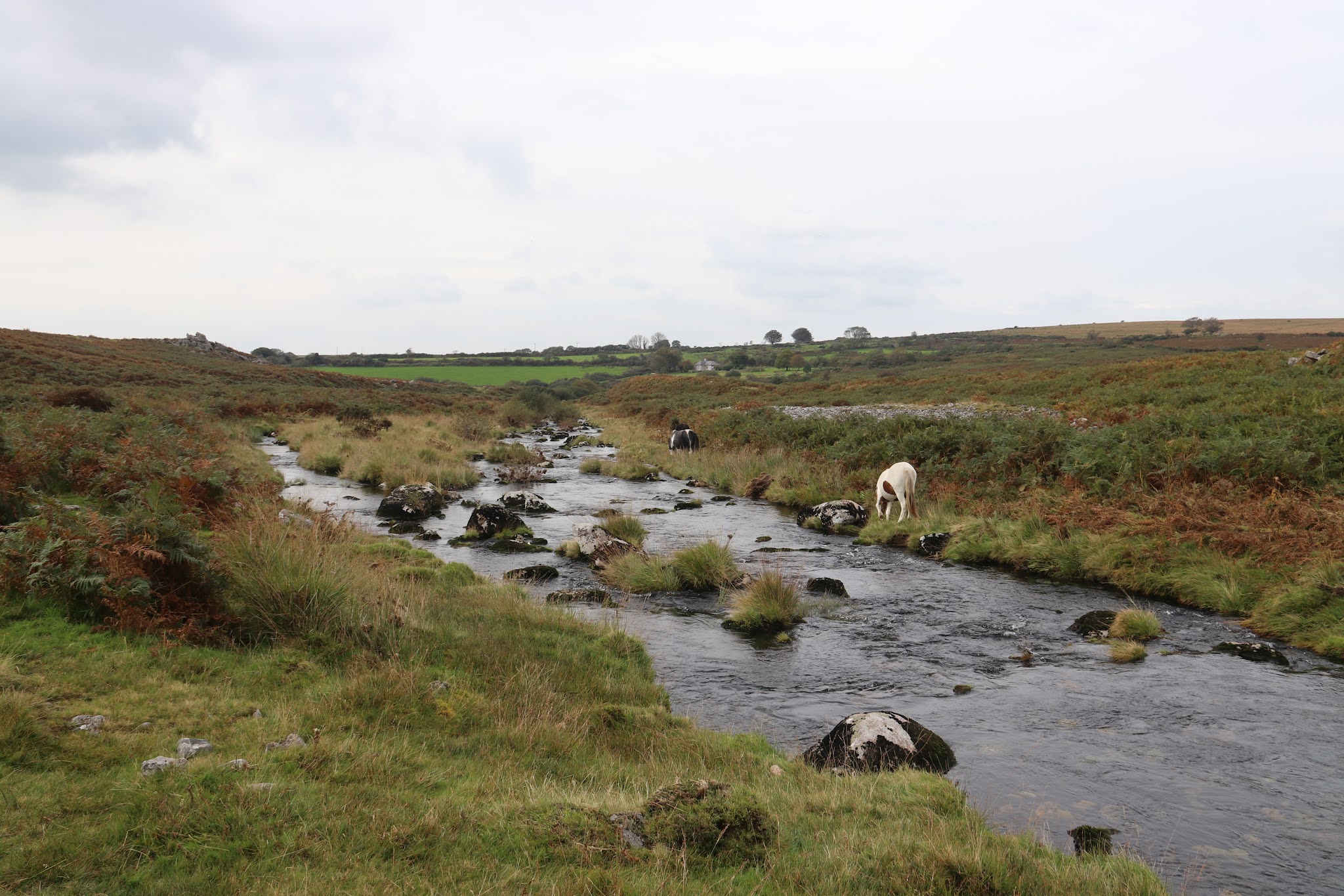
The point where the Rattle Brook, coming from the left, enters the Plym. The Plym curves around to the right and, after a few hundred yards, dwindles to the Amicombe Brook.
Heading up the Rattle Brook to the next waymark, a stone pillar marked WD 21. This is one of twenty two such pillars which mark the boundary of the area purchased by the War Department around 1900. At this point, we turn left and head for Hare Tor.
Hare Tor reveals itself from this angle of approach rather slowly. Dartmoor feels different to Bodmin Moor but we can't quite fully articulate why.  
Hare Tor stands at 531 metres and is a good place to 'tor spot'. To the north can be seen, from right to left, Sharp Tor, Chat Tor, Brat Tor and Doe Tor.
To the west is where we headed next, Ger Tor. And the name 'Hare' is thought to derive from 'Higher' rather than any fanciful resemblance to the said lagomorph.
The walk to Ger Tor was a fairly straightforward ridge trek, with a few boggy bits thrown in for added interest. Ger Tor stands at 422 metres and its name is probably derived from 'Great' or 'Gert'.
From the top of Ger Tor, the views down into Tavy Cleave are fantastic in one direction...
..and down onto the leat in another.
In the distance, under the rather heavy sky, keen eyes can make out Kit Hill. We live on the other side of that.
St Michael's Church on the top of Brent Tor in the distance.
Almost back at the start and we cross the leat one more time.
We were up there! Ger Tor looking much flatter than it seems when you are there.