Showing posts with label Walks. Show all posts

Monday, 12 April 2021

One weekend: two walks

One weekend; two walks over the border in Devon. The first walk was a partial repeat of one we did last week and the other was a new one for us on the edge of the Devon Great Consols mining area.
The first walk was linear, utilising both cars as a shuttle. We started in the car park of the Methodist Chapel in Sydenham Damerel and walked back to the Scrubtor car park. It was just under three miles and was necessary to try and find a thermal top we thought we'd dropped the week before. Nothing ventured, nothing gained.
From the car park, looking across to Bodmin Moor. If you know what you are looking at, you can pick out Caradon Hill and Sharpitor. The tower of the church in Sydenham Damerel is just visible on the left.
A male Orange Tip butterfly, quite common at this time of year. I don't think the Celandine it's perched on is one of its food plants.
Almost at the end of the walk, with Kit Hill in the distance. At this point, we were probably 5 or so miles from home.
Just a granite post with its drill markings. When we had got this far, we had not retrieved the thermal top and we had written it off. 
Our second walk of the weekend was a circular one based on the Scrubtor car park we've used a few times recently. This time we took the Wheal Maria Trail that took us onto part of the Devon Great Consols site and around Blanchdown Wood. As the profile shows, it was a fairly strenuous 4 miles. And, guess what? The thermal top turned up in a rucksack that we'd forgotten we'd used the previous week. Smiles all around.

What used to be coppiced deciduous woodland. It needs a little TLC if it's ever to function that way again.
Buzzards are a common sight and I like the way the edges of the feathers are fringed with halo of light.
And another shot of the same bird. I wonder what it's like to be able to fly...as free as a bird.
The spoil heaps at Wheal Maria. Originally a copper mine, for many years it was the largest producer of arsenic in the world. The heaps were the result of much processing further up the slope.
My walking companions for this one.
Looking across to the spoil heaps of Wheal Josiah. I won't go into these sites in any detail as we really need to go back and have a good potter around. We haven't been up here for years. Perhaps we'll go up one evening to see if we can hear the nightjars that are rumoured to reside in the woods.
There is more detail in the photograph than there might appear at first glance, At the bottom can be seen the River Tamar and, in the middle, some buildings associated with the Gunnislake Clitters mine. Another site we really should revisit.
A Peacock butterfly. Beautiful to look at and, if I was a potential predator, I think those threatening eye-patterns would put me off attempting a meal. Its Latin name, Aglais io, is as delightful as its appearance.

Sunday, 4 April 2021

Lockdown 3 Walks: #4:Lanes, hills, puddles and three parishes

 I started this one a while back so I'll finish...............
This walk was unusual for us as it was all on lanes with almost no footpaths or bridleways (there was just a little stretch at the end when we took the 'back' footpath from Venterdon into Stoke Climsland). We did it as a change at the height of the 'walk local' period and reckoned that the 2 mile drive to our starting point in Stoke Climsland village was within the spirit of the restrictions.

We started and ended at the car park at the Old School in Stoke Climsland. The walk was around 6.5 miles and took us through Bealsmill, Treburley, Penpill and Venterdon. Almost all on lanes, with a couple of 'interesting' hills and touching three parishes - Stoke Climsland, Lezant and South Hill. |And the puddles in the title? Read on.....
There's always something new to see on the lanes and this milestone is one of them. It is classed as an ancient monument by English Heritage and its listing tells us 'Milestone. Probably late C18. Granite. Rectangular section, rounded top. Inscribed "IV/+/C (for Callington)", I think the + means that the distance is taken from Callington church, but it might not be.
Looking over the fields towards Bealsmill Farm and Rezare. Just a nice pastoral scene.
Walking up the hill from Bealsmill, with typical Cornish hedges either side. Drivers beware: the hedges are more than likely to be rather unforgiving granite. Too early from primroses or daffodils.
The banks of the lanes are very effective screens for the surrounding countryside and, quite often, it's like walking in a tree-lined tunnel. But every now and again, a gateway offers a glimpse of what's beyond. If I was being poetical, I'd wax lyrical about the gateways offering a window into the world. 
A letterbox dating from the reign of Queen Victoria - hence the 'VR'. It would have been put up sometime between 1853-1901. Sadly, the number of these is in decline as building are being demolished and/or collections stopped, making them redundant. A shame as I think they are an important part of our social history and make a significant contribution to the character and appearance of the areas in which they are located. Without this one, the wall in Treburley would be just that, a wall. With it, the wall becomes a destination and a focal point for linking Treburley with the rest of the world.
We were actually going down this lane abut I took the photograph looking up. We were heading towards Trekenner Mill at the bottom of this hill. Trekenner Mill is mentioned in the Domesday Book and this lane would probably have been in existence then as the only route out to Trekenner and Treburley. I could imagine the carts being hauled up this incline by oxen and horses.
Two old milk churns acting as guardians to this farm entrance. Objects of mystery to recent generations but I can remember taking them full of milk up to the milk stand by Mr Lewis's farm ready for collection by the Cambrian Dairies lorry. There is a knack to manoeuvring a heavy churn into the right position on the stand. I had it once: I wonder if it's still there? Thinking about it, it is - it comes in handy when I'm shifting our large LPG bottles when they need refilling. A skill for life!
Heading uphill - again - towards Tresallack Farm. The lane to the right heads back to Bray Shop. Hard to believe that the National Speed Limit of 60mph applies to these lanes.
It was about this point that we realised that paddling along the lane in ice-cold water was not a good idea, particularly as we couldn’t make out where the dry bit restarted. So we retraced our route by scrambling along the hedge and then taking a shortcut across a field.
These are becoming quite rare - a block for mounting horses. 
A view of Stoke Climsland church that we don't often see. In the background is Kit Hill and, if you know where to look, you can just make out our house.


Saturday, 24 October 2020

Around and about Warbstow

Another of a trio of recent walks and one we did with friends from Launceston - another North's Choice. And an excellent choice it was, too. As they live about 10 miles north of us, they are choosing routes in areas that we are not familiar with and that adds a lot of interest. This one started and ended in the shadow of Warbstow Bury (more of that later) and was mostly within the Parish of Warbstow, which has an unusual claim to fame. It is one of the few in the country to still have an 'exclave' - an island of the parish in another. In this case, the hamlet of Canworthy Water is surrounded by Jacobstow parish and is separated from the main body of Warbstow parish by some 150 meters. An historical oddity, the origins of which I just cannot find. That irritates me - bad show, Mr Google, bad show. But it didn't spoil my/our enjoyment of the day. The photographs will show what I mean.
This turned out to be a 6.5 miler and the profile doesn't do proper justice to the ups and downs we encountered. A mixture of quiet country lanes, farmland, tracks and footpaths, spiced with a couple of churches, some mediaeval crosses and an Iron Age hillfort. All that and surprisingly very little rain.
Yet another use for tyres. A necklace to hold a tarpaulin down. Typical farmer's ploy - never spend any money when you can botch for free. I've definitely got some farmer's blood flowing through my veins. Nothing pleases me more than fixing a job with something from my seemingly inexhaustible supply of 'things that might come in handy one day'.
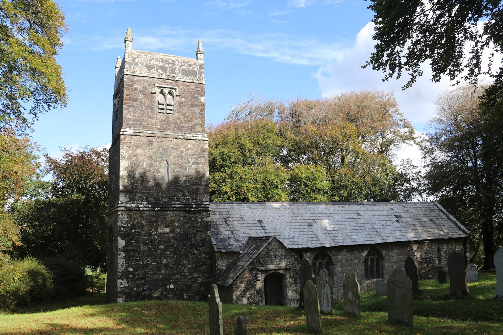
Church #1:  St Werburgh’s Church, Warbstow. Unfortunately closed due to Covid but one to visit when the virus cloud passes. What you see now is, apart from some Victorian tinkering, largely 15th century, with few remains of the two former buildings on this site - Saxon and Norman respectively. The church is dedicated to Saint Werburga, the daughter of  an Anglo-Saxon king of Mercia. She is also the patron saint of St Werburgh's church at Wembury that I've written about before.
They (who are they?) say that no two stone stiles in Cornwall are exactly alike and I can quite believe that as we've encountered many of them. This one is a fine example of a 'coffen' stile, usually written incorrectly as “coffin” stile, and is named after the Cornish word 'coffen' meaning a man-made hole in the ground. This refers to the stile's construction with a pit, not to the ease with which men can carry a coffin across it. Although the stile sometimes has a stone shelf alongside for a coffin (or any other burden for that matter) to rest on while the bearers got their breath back, this is not the source of the name, though presumably the English word coffin is from the same ancient root. Most coffen stiles are associated with 18th and 19th century country mansions or wealthy manor farms and with churches, being convenient for ladies with their long dresses, as the stile, a fore-runner of the modern cattle grid, is walked across, not climbed. Others were built wide enough for a worker carrying two pails with the aid of a wooden shoulder-yoke. Sometimes they were built when an ancient packhorse route was converted to a footpath, after a carriage road was opened.
I think this bracket fungus is Chicken of the woods (Laetiporus sulphureus) but I would welcome being corrected.
This cross was found at Higher Youlton in 1976 buried upside down and used as a gate post. It was moved to its present position at Youlston farm some years later and reset on a new base stone.
This cross was originally used as a bridge over a nearby stream and was re-erected by the Old Cornwall Society in 1936 - as the little plaque to the right of it said. The stream forms part of the parish boundary so its present position is quite logical - such crosses were frequently placed at key junction points.
Panoramic views all the way around on this walk. This is a very sparsely populated area and, in many ways, is quite remote. In the distance, the high land of Dartmoor can be made out.
My fungi identification book points me in the direction of Many-zoned Polypore (Coriolus versicolor) for this one. Looks reasonable to me.
I presume that, at some stage, the occupant of the caravan will realise that this isn't the best place to be a fisherman. The high tide never quite gets this far so launching the boat might pose a few problems.
Church #2: St Gregory's, Treneglos. Guess what? It was closed and is added to the list for a revisit. There has been a church here since Saxon times; in the Domesday Survey of 1086, the church was given to the Priory at Tywardreath. The church was confirmed as the Priory's by Bishop Chichester on 14th February 1154. The present church was rebuilt in 1858, and the tower, having become very dilapidated, was taken down in 1871 and completely rebuilt; its four bells were reused.

The sculptured Norman tympanum, similar to other works in nearby churches such as Egloskerry, is described as "a conventional tree in the centre, with a pair of beasts having their tails bent round between the legs, and upwards across their bodies, placed symmetrically facing each other." The meaning may be found in the Psalms verse about the vine of Egypt: "The boughs thereof were like goodly cedars... The boar of the wood doth waste it, and the wild beast of the field doth devour it."
VR? I wonder how many of this vintage are still around? And I wonder how many will remain in 5 or 10 years still with this livery? Precious few, I think.
Every war memorial is unique and every one has tales to tell. This one in Warbstow is no exception. Amongst the fallen of WW1 is Lance Corporal John Stapleton who had emigrated to Australia and was killed at Ypres whilst in the 55th Australian Infantry Battalion. One other thing about this memorial that's interesting is that it's the only one I've come across that names the women from the Parish who served in a war. In this case, WW2 and noted the service of seven women in the ATS, WAAF and NAAFI. It was good to see this.


The first photograph of this pair shows part of the surviving wall structure of Warbstow Bury. The size of this hillfort means that it's impossible to get an image that does it justice. Hence I thought that the photograph of the information board at the site would give a better idea of layout. Here's some information I've plagiarised from the English Heritage listing.
Warbstow Bury (
above), a multivallate hillfort in north Cornwall, is one of the largest and best-preserved hillforts in the county. It is also known as ‘The Giants Grave’ after the legend that a giant that lived here was killed when the giant of Launceston Castle threw a tool at him. It also called ‘The tomb of King Arthur’ although there is absolutely no evidence whatsoever to substantiate this. It has two ramparts, with two entrances each, the inner one measuring 370 by 450 feet. The outer rampart averages 15 feet in height, with an external ditch 15 feet wide. After the abandonment of the hillfort in the late Iron Age, the site is unlikely to have been used frequently for anything more than the summertime grazing of sheep in the early medieval period. The inner-circle was used as a beacon for the jubilee of Queen Victoria celebrations in 1887.
The Bury really is an impressive site and, as we did not know much about it, came as a complete surprise. This image is taken across the breadth of the central portion and keen eyes will make out the mound in the centre. Mythology gives this as the site of the Giant's Grave but it is thought that it's most likely to be the remnant of a mediaeval pillow mound that housed rabbits. The rain clouds in the distance did not come our way, I'm glad to say.
The central portion at the top of the Bury, clearly showing its circular shape.
"And this is what we think of you".
Looking north from the Bury towards Exmoor and the North Devon coast. We could just make out Lundy Island.

Friday, 7 March 2014

Ch..ch..ch......changes

Today we lead the walk we reconnoitred last week (see here) for our U3A Walking Group. Apart from the company, I think the theme for the day was 'changes'. Even though the route was the same, it was interesting to see the differences the passage of a mere week made. Possibly the most notable was the weather, as some of the photographs below show. Nonetheless, another excellent walk and one that we shall do again, ideally when the bluebells are out.
The view today..........
...and last week.
Today...................
.......and last week (but not quite the same spot for the shot).
Daffodils and snowdrops last week..................


......and slightly more daffodils and fewer snowdrops this week. I was surprised that the daffodils had not come out more since last week.
The tide was out last week but was coming in as we walked passed the quay today.
 
More primroses out this week.

Lots of navelwort covering the banks and walls. It is also known as Penny-pies, Wall Pennywort and, more locally, Pig's Bum. It's a perennial and its fleshy leaves are quite edible (and tasty). Later on it will be covered by upright, rod-shaped flowers. It's Latin name - Umbilicus rupestris - derives from its umbilicate (navel-like) leaves. Rupestris means 'living near rocks'. I'll always know it as Pig's Bum!
 
Lesser celandines (Ranunculus ficaria) are starting to show their bright flowers. According to the Oxford English Dictionary, celandine comes from the Latin chelidonia, meaning swallow: it was said that the flowers bloomed when the swallows returned and faded when they left. The name Ranunculus means "little frog or tadpole," from rana "frog" and a diminutive ending. This perhaps refers to many species being found near water, like frogs, or to the fact that the unopened flowers resemble tadpoles. Who knows but, whatever is correct, it's a nice story.
And when talking about changes, I simply can't ignore the David Bowie song of that name from his Hunky Dory album. It may be 40+ years old but it's still great. Enjoy!