Sunday, 30 June 2019

From Pentireglaze to Port Quin and return

It was going to be a hot day so what better way to spend it than walking along the coast? This time we were filling in a gap between Pentireglaze, just outside of Polzeath, and Port Quin. After we've finished this bit, we've only got about 30 miles of the Cornish Coastal Footpath to do to complete our challenge.
The route was out and back along the coastal footpath. Navigation was easy - keep the sea to our left on the way out and to our right on our way back. At around 4.6miles, and over moderately challenging terrain, it was far enough under the hot conditions.
The satellite view of our route.
A thistle of some sort. I really should make sure that I get leaves and a side shot of flowers so that I'm better able to identify them. But, whatever it is, it adds a splash of colour to the sides of the footpath.
Unfortunately we missed the coastal flowers at their prime but the remnants, such as these seed heads of Thrift, are still photogenic.
Looking westwards towards Rumps Point with the small island, the Moule, lying just off shore. Rumps Point is, in fact, a twin headland, enjoined with Pentire Point, which would be to the left. Continue around and you'll get to New Polzeath and Polzeath. Both feature prominently in the world of surfing.
Two people painting the coastline. Looking at what they've done so far, I'm not sure they are seeing what I'm seeing when I look from this point. But it's probably too early to judge. The finished products might be absolutely amazing. I did offer to pose for them in a Poldarkesque fashion but they weren't impressed.
An interesting rock formation we came across called Lundy Hole. It's actually a collapsed sea cave. Legend has it that, as St Menfre was combing her hair, the Devil appeared in front of her. She threw her comb at him with such force that in his haste to get back to hell he dug Lundy Hole. And who was St. Menfre? According to the Cornish lists,Menfre, alias Menefreda, was one of the many holy daughters of King Brychan Brycheiniog (we've come across his progeny at other churches around us). She appears to have been active in Wales,around Minwear, near Haverfordwest, in Dyfed but, later, left her native land in order to evangelise the Cornish.She settled at Tredresick and then the place now called St. Minver, near Padstow, and apparently lived an austere life there in her little cell.      
Guess who has got a new rucksack?
One of the pleasures of walking the coastal footpath is coming across little coves that are quite isolated and rarely visited by anyone. Of course, the reason for this might be that they are inaccessible because of the steep cliffs.
Now here's an odd thing: my dislike of cold water is well known but, when I see the sea as inviting as this, I'm almost tempted to take a dip. To be honest, that's not quite true but I did ponder on the possibility of carrying a half-suit on the off-chance that the mood takes me again.
Kellan Head in the distance with Doyden Point in the mid-ground and that's where we were heading.
In 1827 the headland at Doyden was bought by a wealthy Wadebridge bon-viveur called Samuel Symons. He built this truncated Gothic tower, gradiosley known as Doyden Castle, as a place to entertain his friends, where they spent their time drinking and gambling. You may recognise it as the place where Mrs Tishall held Doc Martin's offspring hostage in an episode of the eponymous TV series. It was also used in Poldark, Nowadays it's used as a holiday cottage by the National Trust. Whilst on the subject of Doc Martin, I do believe we had previously passed the actor who plays PC Penhale out for a walk on the coast with a lady companion. As they are filming the next series in Port Isaac at the moment, it's not impossible - either that or John Marquez has a doppelganger.
And here it is in infra-red.
 There were two mines at Port Quin and near Doyden Point, there are the  mineshafts of Gilson's Cove Mine either side of the coastal path. This was a mixed lead/silver and antimony mine from which a little copper ore was also extracted. This shaft goes down to sea level, the other, close by, deeper. Keen eyes at this point will spot the remains of the platform for a horse-powered winding device, known as a whim, which was used to haul ore up from the mine. Look out for the flat, circular area where the horse would have travelled, tethered to the winding gear.
I haven't come across a gate of this style before and couldn't figure out why there were three removable lateral pieces. These didn't seem to add anything in terms of access or barrier over and above the gate to the right. I'm open to suggestions - sensible or otherwise.
Most of the dry stone walls we passed were bedecked with the spikes of Navelwort or Pennywort (Umbilicus rupestris). I think I've mentioned many times before that a local name for this is Pig's Bum, becuase the indentation in the middle of the leaves looks, to some. more like a pig's bum than a navel. I'm neutral on this matter.
It's that new rucksack again, this time going downhill.
A Cornish traffic jam. If it's not tractors, it's pheasants.
And then it was back to feed our Oxford Sandy and Black pigs. Nice healthy looking animals but much more feisty than our previous breed.

Wednesday, 26 June 2019

A visit to Lundy Island: Part 2

It was a "why haven't we done this before" occasion when we went to Lundy Island recently. It lies just off the coast of North Devon and, as such, cannot be classed as remote and inaccessible. Perhaps it's a good example of never visiting places that are on your own doorstep. If you haven't been, do go. And we'll be going back to complete our circumnavigation. I've already posted the best of the IR photos I took (here) so here are some full spectrum images.
Lundy Island is about 8 miles off the coast of North Devon and lies in the Bristol Channel. It's around 3 miles long and 1/2 mile wide and has a chequered history of human habitation that stretches back some 4000 years. After many years in private ownership, it is presently owned by the National Trust, with most of the buildings being managed by the Landmark Trust. There are 23 holiday rental properties there if you are interested in staying. The regular/irregular ferry service departs from Bideford or Ilfracombe depending on the tides in the summer months. Over the winter, there is a helicopter service for those who can afford it. The trip takes 2 hours each way. In our case, it was a very smooth and pleasurable voyage but it could be oh so different when the water is rough.
The landing jetty on Lundy, with Rat Island just to the 'back' of it. The MV Oldenberg, the usual means of getting to the island, is tied up alongside the jetty.
Sheep's Bit Scabious, although it is not strictly speaking a scabious but a bellflower. At this time of year, there is lots of it around the coast. The flowers are rich in nectar and are very attractive to bees and butterflies. Sheep allegedly enjoy eating it, hence its name. It is also known as ‘blue buttons’ due to the shape of its flower heads.
The Lundy Cabbage, Coincya wrightii, is a species of primitive brassica growing only on Lundy and nowhere else in the world. Its nearest relative grows in southern Spain and North Africa. It is likely that Lundy is far enough away from the mainland to have allowed the plant to evolve into a separate species.It is one of about a dozen endemic plants in the British Isles. However, even amongst this select company, it stands out. It is unique in having its own endemic insects. There is a Bronze Lundy Cabbage Flea Beetle, Psylliodes luridipennis, and the Lundy cabbage weevil Ceutorhynchus contractus pallipes, which live only on this plant. If all the areas of growth on the Island were put together, it would cover a square of about 100m, which, for the total world population of a plant, is miniscule. Wow, fancy that. Rare it may be but it's a cabbage in name only as it is considered to be inedible by many. I tasted a leaf and it's not that bad. Mind you, my hair fell out soon after so that probably wasn't a good idea.
Lunch at South West Point, with Great Shutter and Little Shutter Rocks in the mid-ground. In the far distance is Cornwall and I'm inclined to think that the farthest westerly point we can see is Pentire Head. Coincidentally, that could be where we next walk a stretch of the Coastal Footpath.
The rocks at Jenny's Cove where you can just about make out the colonies of nesting puffins, razorbills and guillemots. Too far down for a decent photograph. Due to the success of the rat clearance programme, the numbers of ground nesting birds, and the puffins in particular, are increasing. And why the name 'Jenny'? Named after a three-masted schooner that was wrecked here in 1797 and which carried a cargo of ivory and gold dust.
For those who want a puffin-fix, here's a group we encountered on the Isle of Lungha off Mull in 2017.
In the 1860s, granite quarries were opened on the island but they were short lived, lasting for less than a decade. These are the remains of the hospital that was built then.
The Old Light which was built in 1819. It turned out that the elevation for this was too high to be effective and it was eventually abandoned when lighthouses were built at the north and south ends of the island.
The remains of the cottages associated with the managers and administration of the quarry. When we first came upon them we were impressed with how sturdy they were and thought that they really knew how to look after their workers. Wrong! The workers' cottages were demolished long ago.
 It is thought that the original feral goats died out and a new herd was brought to the island by farmers, lighthouse keepers and quarrymen during the 19th century. This has since been supplemented with new additions and this mixed ancestry can be seen in the population as there is a mixture of coat colours, horn growth and coat length. 
In 1928 a herd of fifty ponies was introduced to the island in an attempt to establish a new breed of pony. This herd mainly consisted of New Forest ponies, a breed which were readily available from the local area, however, Welsh Mountain ponies were also used to give the breed “style and height”. The Lundy pony is now an officially recognised breed, with a herd of approximately twenty ponies being kept on the island. The ponies remain in the Pondsbury area between Quarter and Halfway walls. As we can attest they are used to people and took a keen interest in what we were eating.
A Whinchat, migratory rather than resident. The 'whin' part of the name reflects that they like using gorse (whin) as a habitat. Its close relative, the Stonechat, is more likely to be seen hopping on rocks. Both of them have an almost metallic call, that sounds like stones being hit together. Mmm, that doesn't make complete sense, does it? But you know what I mean. Or maybe you don't.
Another Whinchat and, if you look closely at its legs, you can see that both of them carry ring bands. I think I can make out two on each leg. I've failed to find out what the colours mean.
A pipit of some sort - Meadow or Rock? I'm not very good at discerning the various types of pipit. Except when I'm in the middle of Dartmoor and it's only the meadow variety that you'll see. 
Just a stone wall with seasonal flora, including a lot of Stonecrop (Sedum anglicum).
The stained glass window in St Helen's church, a Victorian structure built from the local granite.
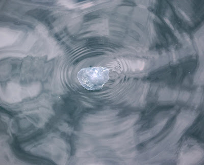
Lots of jellyfish were drifting just off the quay. This one is, I think, a Moon Jellyfish.
A day boat returning to the fish harbour in Appledore, with an accompanying flock of seagulls feasting off the entrails being thrown overboard as the fish are gutted.
And with Lundy receding in the distance, we come to the end of a delightful day. We will return.


Sunday, 23 June 2019

A visit to Lundy Island: Part 1.

Some infra-red images from our recent trip to Lundy. Full spectrum photos and more information will follow. I just need to get these up for someone.
Appledore
Bideford
A wreck on the River Torridge
Arriving on Lundy
St Helen's Church
Abandoned quarry managers' cottages
A seascape at Jenny's Cove
The old hospital
South Light
 

Friday, 21 June 2019

The Challacombe Circular Walk

The weather was iffy but not bad enough to put us off walking on Dartmoor with five others from our third Thursday of the month group. This time we headed off to the middle of the moor and took what we know as the 'Challacombe Circular Route'. A walk that has a bit of everything - bronze age monuments, a mediaeval settlement, at least six hundred years of industrial archaeology, some WW2 artifacts, a trig point, great views all the way round and a good stretch of the legs (and lungs). What better way is there of spending a day? Daft question, really: each to their own. But this is ours.

Geek alert: I took this opportunity to try some experimental shots with my IR camera. I'm still trying to find out what it is best suited for and I've included a few frames below. For those interested in this sort of thing, it's a Canon 100D body that's had its full spectrum sensor replaced with a 720nm one. I've used grass to set a custom white balance and post-editing is done in Photoshop CC and Lightroom CC.
The route, which turned out to be around 7 miles, started and ended at Bennett's Cross. We skirted Birch Tor, went over the top of Hookney Tor and dropped down to Grimspound. From there, ascended Hameldown, walked the ridge for a mile and then descended the hillside to Challacombe farm.
Out of the car and this is the view that greeted us. Looking down the valley that we'll return through. It's hard to believe but this landscape has been largely shaped by man's activities over the millenia.
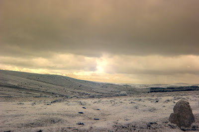
An IR shot from more or less the same spot as the image above. Setting the white balance from a green source means that greens, such as grass, come out as white. It's easier to do this 'in camera' than let the auto white balance produce the standard red IR image, which I find hard to assess. Although the image looks atmospheric, I'm not convinced that IR adds anything to this sort of subject.
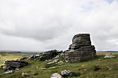
Hookney Tor.
Hookney Tor in IR. Gives a different feel to the image. IR gives sharper images when there are solid objects like rocks. And, yes, I know there's a touch of lens flare even though the sun was not shining at this point. Note to self: get a hood for this lens.
The group walking down the side of Hookney Tor to the Bronze Age settlement of Grimspound. Twenty four hut circles within a double skinned outer circular stone wall. The IR image at the bottom really makes the outer circle stand out and gives it a bleakness that I'm not sure I like.

One of the hut circles at Grimspound. Originally the walls were probably some 6 to 8 foot high with an apical roof thatched with ferns or whatever plant material could be utilised.
The trig point on Hameldown Tor. I'm a fan of trig points but no fan of the fad of creating artificial cairns like the one behind. In some places there are essential for navigation but not here. It always concerns me that archaeological artifacts can be displaced in making these cairns.
The marker stone at Two Burrows/Barrows at the end of the Hameldown ridge. I think this IR effect is quite menacing.
Guess which way the wind blows from?
The same trees with the IR camera. It looks like a snowy scene (remember white = green) but the resolution isn't as sharp as I would like. When, or if, I get the time, I'll see what Lightroom can do to improve matters. Another note to self: make sure to carry a spare IR battery.
One of the farms in the mediaeval hamlet that once thrived at Challacombe. Mentioned in the Doomsday Book, there were some 9 - 12 households at one time but these have diminished to the one that there is now. It's called a 'shrunken settlement' because of this process. 

The main pond at Challacombe. Wildlife friendly and we enjoyed watching the swifts and house martins skim the top of the water for insects.

The moss gives a clue to the climate here - wet and humid.

Lots of Highland cattle around the old mine workings. They are hardy and very good at keeping the bracken down by trampling on it.

On the side of the hill just up from Challacombe Farm is this set of lynchets - the remains of the mediaeval field system.

Southern Marsh Orchid. Lots of them around at this time of year.