Wednesday 25 May 2022

Oh, we do like to be beside the seaside

    Circumstances gave us an afternoon in Tintagel and we decided that we'd walk a shortish stretch of the Coastal Footpath. Tintagel as a village is not my favourite spot in Cornwall. It's far too busy and full of tat associated with King Arthur - Merlin Burger anyone? But the castle, and the new bridge, are well worth visiting when it's quiet. Best to go out of season. Or better still, do what we did and don't stop! Ignore me, I’m just an old curmudgeon. Go and enjoy yourself and why not buy a plastic sword and shield? Or a full-sized round table?

We started in the car park next to St Matriana's church on the outskirts of Tintagel. We've been there several times previously and it has some very interesting stained glass windows. But today was about walking and not spending too much time church visiting. Top tip: the car park by the church is free.
A straightforward 3 mile walk. Out of the car park, turn right and walk along the coast for about 2 miles. Then take a left and follow a few paths back to the church. 
A few steps from the car park and this is what in front of you.
If you look to the right, eastwards, you can see Tintagel ‘Island’ where the castle is. Look carefully and you can make out the hordes as they pick their way around the ruins. And spend more time dwelling on who wasn’t there than those who were.
If you look down, you can see drifts of Thrift and the amazingly blue sea.
And to the left - westwards - we can see across Port Isaac Bay with Gull Rock, off Trebarwith Strand, in the mid-ground.
Armeria maritima - thrift, sea thrift or sea pink. Extremely prolific along the coastal footpath at this time of year.
Another coast-scape looking east. The Youth Hostel at Tintagel can be made out. It has a spectacular view and all for a very reasonable fee (I assume).
At low tide, this is one long sandy beach. The Prince William pub at Trebarwith Strand can be made out in the distance. Good place for a drink with a view but a very steep descent to reach it. We skipped that this time around.
Swathes of Thrift along a bank.
A slate stile, some thrift and a dry stone wall with a herringbone pattern. Three distinctive features on this walk.
All along this stretch of coast are the remains of a series of slate mines/quarries. All long gone but these stacks stand testament to their presence. The stacks were formed when all the valuable slate was removed around them, leaving the core of harder, commercially valueless stone.
A few more stacks and a couple of ruinous mine buildings. At one time, the area would have resonated to the sound of the mines/quarries being worked. But all things must pass.
Wheatear on a rock. A lively little Summer migrant and there were lots of them flitting about.
A dry stone wall showing the herringbone pattern that comes from using relatively thin sheets of slate. Also called a Jack and Jill pattern.
The above in grey scale.
A rather ferocious guardian of a holiday let. 

Sunday 22 May 2022

Yelverton Circular

 A nice sunny day and our Thursday walk took us across the Tamar into Devon. It promised to be a good day. Was it? Read on........................

A pretty straightforward route for this one: assemble at Yelverton and then head south along the cycle way for a couple of miles. Then follow Drake’s Leat over open moorland before dropping down to the rivers at Shaugh Bridge. From there we negotiated a riverside path along the West Bank of the Meavy back to our starting point. A delightfully varied walk and one for which we clocked up 7.8 miles, our longest for a while.

I did say that we walked along the cycle way and so we did. But it’s much more than that. This is the most obvious/flattest way to get from the moor to the bustling towns and ports of Plymouth and Devonport. As such it’s full of history with two leats and a mineral tramway in the vicinity, almost running parallel to each other. Of course, you can walk or cycle without knowing any of this. And why not? But a knowledge of the history does help you interpret what you come across and put them into a proper context. And, to my way of thinking, making the walk much more interesting. The above information board is a good place to start your quest for knowledge.
Granite sleeper beds for the track of the old Plymouth and Dartmoor Mineral Railway/Tramway, which took  minerals, including granite, down from the moor to the waterside and Plymouth. It dates from the early 1800s and was later superseded by the steam railway. Until then, horse power ruled supreme and it must have made the journeys very leisurely affairs.
Drake’s Leat which took water from the River Meavy down to the North Hill reservoir in Plymouth. Drake was a canny devil as he charged mills, farms etc a fee for getting supplies from the leat. Looking at the granite slabs lining the sides gives you an idea of how much effort went into building it. It was built to last, and it has.
Just a panorama looking east-ish with Sheepstor in the distance. A green and pleasant land.
Meals on the hoof. The mare was not too impressed with being hassled by the foal for a meal. But it got there in the end.
Where two rivers meet. The Meavy come in from the left and the Plym from the right. The relatively dry spell we’ve had recently meant that there was none of the usual dramatic torrents.
We followed a footpath along the West Bank of the Meavy. Mainly in dappled shade. A kingfisher zoomed past but I missed that.
There were enough obstacles to make it a little more adventurous than normal. What joy is there in a completely flat walk with no chance of tripping and breaking an ankle?
And when the path becomes impassable, you scramble up to the next level, assuming that there is one and not just more of the same. In this case we were fortunate as we came out on an old railway track.
These are quite ancient deciduous woodlands with gnarled trees to match. And a suitably gnarled person with a camera to take the photograph.
This stump has been in situ for a while. An interesting shape with lots of hiding places for insects.
The white of the May blossom makes a marked contrast with the green of the other trees.
A few residual Bluebells. Well  passed their best but still with enough colour to give the glade a blue shimmer.
And a few more against some very lush Ground Elder. Is this the last few Bluebells we’ll see this year? Everyone says it’s been a good year for them but, strictly speaking, last year was the one they should be praising as that’s when the strength of this year’s growth is laid down. Will this year be an equally good year for next year’s bulbs?
And lastly, the sound of running water. The River Plym taken from Shaugh Bridge.

Monday 16 May 2022

Lowery Cross to Walkhampton and back via Routrundle

A lovely day for a walk and this one fitted the bill very nicely. A mix of quiet lanes, an ancient church, open moorland and a disused railway track. And a few more Bluebells.
We started this walk just north of Burrator at Lowery Cross. From there we descended to Walkhampton, ascended to Walkhampton Church, descended again to Eggworthy, ascended yet again to Routrundle and then had a level couple of miles back to the starting point. My GPS clocked it as 6.5 miles. The weather was good but not warm enough to make it uncomfortable. One worth doing again.
The view from our starting point. Brentor can be seen in the distance and we were heading in that rough direction. Very rough, in fact. So rough that we went absolutely nowhere near it.
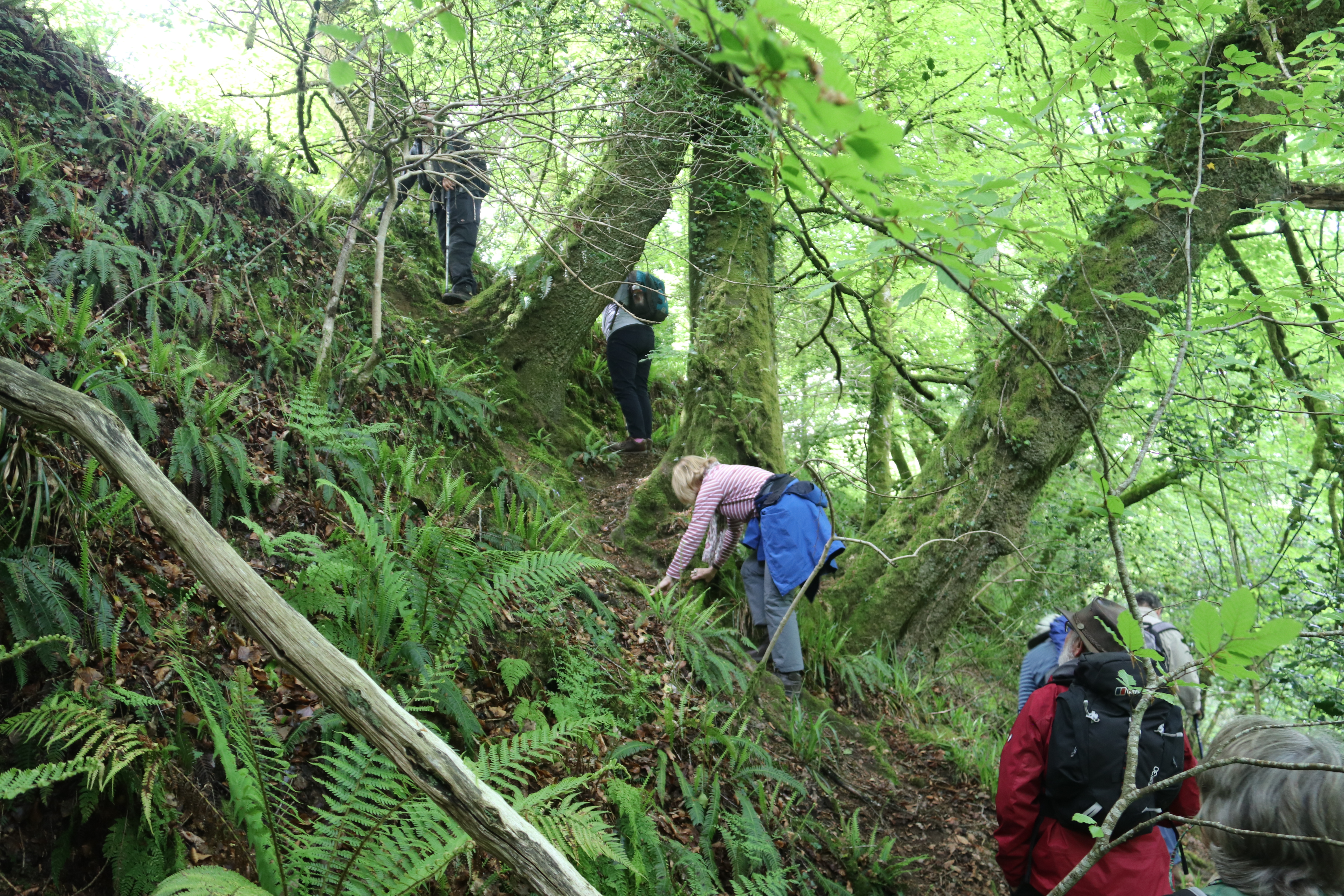
After a reasonably energetic hill climb, the church came into view.
St Mary’s Church Walkhampton lies half-a-mile north of Walkhampton village on a lofty elevation (700 feet). Occupying an ancient site, it was built long before the village began in the river valley below; hence the unusual distance from 'civilisation'.. Another curious feature is that it faces north-east, the point of sunrise on the longest day, rather than due east. This alignment also points exactly to Gipsy Rock, possibly the meeting place of the Saxon Walkhampton Hundred. Design? Coincidence? A builder‘s error? Who knows?

 For 400 years until 1985, the church had no dedication and was known simply as "Walkhampton Church", but in that year it was dedicated to St Mary the Virgin. Research has  since indicated that it may have been originally dedicated to St Dionisius of Walkynton.

The current church has been here since about 1450, but records show that there was a church here in about 1341 because an Archdeacon wrote and said 'It's falling down. Please do something about it.'" There was probably something on the site well before that as well.

Although St Mary the Virgin isn't about to fall down, an extensive reordering project has been completed in recent years. The works included the installation of glass screen doors, the restoration of an old wooden screen, a new kitchen, drainage, and a spiral staircase ascending to halfway up the church tower. It all looks very welcoming, especially the engrave screen doors which are the first feature that greets you when you enter. They are decorated with local scenes of Dartmoor - ponies, tors, wayside crosses etc. Very impressive and well worth visiting in their own right.

There's some very nice stained glass in Walkhampton Church and I particularly liked this window from the 20th Century.
A detail from the above. Stained glass can be so expressive.
For those who like sleeping in cold, damp buildings, 'champing' in St Mary's might be just the thing to go for. Another income stream, utilising what assets the building has. There is a toilet and kitchen and they do provide a table and chairs. There's also good broadband from a receiver on the church tower - installed as a community facility a while back and serving the farming community in the vicinity.
The CWGC headstone for Stoker First Class Silas William Chapple, who was 49 when he died. He served at HMS Drake, the main naval barracks at Devonport and an RN accounting base. Given this and his age, I'm assuming that he either died of ill health or of an accident at the base. He was a local lad and seemed to have been born, raised and married in Walkhampton. For completeness, he was the son of George and Rose Chapple and husband of Ella Helena Chapple, all of Walkhampton. 
At this time of year, practically every dandelion 'clock' must be photographed by someone or other.
Except, probably, most of these. We walked through several such meadows filled with them and the flowers of later flowering varieties of dandelion. Plus a few buttercups.
Looking down and towards the valley through which the nascent River Waltham runs. Lots of fresh growth on the trees with some tors in the distance.
Eggworthy Farm - an eggcellent place to get your eggs? Not really. £1.50 per 1/2 dozen? We only pay £1 for ours down the road.
We came from Eggworthy and headed towards Criptor. In the background, Pew Tor can just be made out.
Looking towards Ingra Tor. One of the Dartmoor tors with an associated granite quarry. Not on our route today but it’s an interesting place to scramble around and look for quarrying artefacts. When the railway was operational, there was a small station or halt at Ingra Tor. How busy would it be with walkers if it were still in existence?
Four tors on the skyline - from the left they are Pew Tor, Cox Tor, Great Staple Tor and Great Mis Tor. We’ve climbed all of them at one time or another.
The trackbed of the old Yelverton to Princetown railway is very popular for walkers and cyclists alike. It offers easy access to some wild parts of the moor and can get quite busy 'in season'. But at this time of the year, it's nice and quiet. We never walk the entire route but bits and pieces of it feature on several of the walks we do around here.
Almost at the end of the walk and the panorama looking to the north-west. In the distance Kit Hill is visible and in the mid-ground to the right is Walkhampton Church. 
And did someone mentions Bluebells? There were plenty of them still around. The elevations of Dartmoor mean that they don't come out all at once.
Here they are by the roadside............
..........and in a glade by Eggworthy.