Tuesday 29 December 2020

Three miles downhill and three miles uphill: a walk from Minions

 As we are in Covid Tier 2, it is permissible for recognised walking groups to meet and walk. Hence a walk with one of our groups. The weather could have been worse but we did have quite frequent showers and a cold wind coming in from the North-East. We also had flashes of blue skies and the occasional rainbow. All that with good views. It was a day when the covers went on and off my camera many times so it wasn't a great day for photography.
We started and ended our walk in the Hurlers' Car Park in Minions. It was a fairly simple walk to describe - three miles downhill, have lunch and then three miles uphill. We dropped down through the Gonamena Valley to Crow's Nest and Tremar and then back up via Trenouth and the eastern side of Gonamena/western side of Caradon Hill.
With the salubrious Minions sewerage works on the left, the waterlogged path gives a good idea of  the amount of mud and water we sloshed through regularly. It looks worse than it actually was or so methinks.
Looking over wet and muddy fields towards the coast in the distance. I guess it's vaguely in the direction of Looe.
Rosecraddoc Wood.
Negotiating our way over a clapper bridge to our lunch stop. Hooray, we've finally disposed of all the remaining Christmas Day turkey.
A feature in the wall of a barn at Trenouth Farm. It has obviously been relocated from elsewhere as there was nothing else about this barn that suggested any degree of antiquity.
The engine house associated with Jope's Shaft at the bottom of the Gonamena Caradon Mine complex.
It's competition time! How many engine houses and stacks can you count?
And here's one that is not in the last image. The remains of the engine house of the North Caradon Mine.
Flush Bracket S3439 but attached to what?
The trig point on the top of Caradon Hill, that's what. Apparently it's the 1892nd most popular trig point in the UK.
One definition of a rainforest is ‘where the climate is wet enough for plants to grow on the branches of trees’ . Here on the west facing slopes of Caradon Hill 12 inch long lichen hangs in the ‘rainforest’ branches of the hawthorns looking like something out of the Lord of the Rings.


Tuesday 22 December 2020

Just a late afternoon walk from the ford

The weather has been pretty lousy recently and our local streams are running in full flood, or so we are told. A short walk in the late afternoon to check out the one that runs alongside a frequent route of ours down at Broadgate.

Looking back up the lane to Downgate. All looking very damp and wintry.
I've never heard anyone call this by any name other than the Luckett Stream. There's got to be x10 the normal volume of water coming down now. 
Of all the trees that are in the wood ......this is one of the few to be laden with lichen. Not sure why this should be as there doesn't seem to be anything special about this one in terms of light etc.
I like this line of trees on top of this short stretch of wall. I think the wall must be related to the old mine, Wheal Sheba, in some way.
A veritable torrent coming through what were once gates controlling the flow to the various waterwheels that were once downstream.
Just a wood in the later afternoon as the light gradually lessens. And all was silence. 

The lane back up to Downgate, about 1 hour after the first one.
And there are two cyclists coming through the ford.
And for those who like the sound of running water, take a look at this. In the warmer months, our grandchildren have been known to swim and/or paddle here. But not now. Having said that, I suspect that at least one of them would have a go if we let them.

Friday 27 November 2020

(Yet) Another walk from Minions - circumnavigation of Caradon Hill

The weather was set fair and our chosen walk was around Caradon Hill. We've done this one many times but it's yet another that repetition does not reduce the pleasure.
We started at the Hurlers' car park in Minions, headed down through the Gonamena Valley and then around Caradon Hill back to Minions. Just over 5 miles of quite easy walking, with views all the way around.
The abandoned cottages at the top of the Gonamena Incline are known as Ponton's Piece, and are thought to predate the railway that runs beside them. I took this shot ignoring the rule of not pointing the camera into the sun. I like the result as I think it captures the atmosphere of the moment. Long shadows and low clouds in the distance.
This stone marks the top of the Gonamena Incline - LCR = Liskeard and Caradon Railway. At the end of each working day, the heavy, loaded carts would begin their steep descent, with a brakeman on each to keep their speed below the limited 12mph.  In 1859, it is documented that there were 27 brakesmen working on the incline.
Spoil heaps and stacks associated with the various mines of the South Caradon complex.
Jope's Shaft engine house to the right and Holman's Shaft engine house in the middle of these three.
I never visit these old mines without thinking of Mrs P's great, great uncle, John Henry Cook. He started working in the mines in Menheniot when he was seven and then moved to those on Caaradon Hill. In his early 20's, he emigrated to Australia and ended up running a gold mine in Charters Towers in Queensland. His photograph shows him in his Salvation Army uniform.
Looking southwards towards the sea in the general direction of Looe. And in case you are wondering, I've not done anything in the way of post-editing on this one.
A collage from three buzzards. I do like these birds and am so glad that their numbers are on the increase. These three might have been a family group.
What can I say? A tree with Sharptor in the background.
IR shot of mine buildings associated with Jope's and Holman's shafts.
An infra-red tree.

Saturday 21 November 2020

Midweek Walk at Minions

 The weather recently has been pretty rubbish but today seemed to have a break in the rain so off to Minions we went to stretch our legs and get some fresh air. All socially distanced and following all of Lockdown V2 rules, of course.
We've done this route a few times and it's always worth repeating - different weather, different season, different time of day etc. We made a slight diversion to the back of the quarry and the distance we clocked was just over 4 miles. No rain but the wind it did blow and it certainly wasn't warm.
A partial rainbow over the Cheesewring and Stowe's Hill. An interesting layering affect in the sky.

Not a lot of birds around but we did see several flocks of Golden Plovers wheeling around. By my estimate, there must have been between 50 and 100 birds in each flock.
Gold Digging's Quarry is an abandoned flooded granite quarry on Craddock Moor on the South Eastern edge of Bodmin Moor. It used to be a quiet peaceful location and it still is for most of the year. But the quarry is very popular with wild swimmers and rock climbers and can get very busy.
Guess which way the prevailing wind blows?
Wrong! It blows this way.
The granite sleepers of the old mineral railway in the foreground and Sharptor in the distance.   
Looking eastwards towards Kit Hill and home.
Looking over what used to be the Phoenix United mine which ceased working in the late 1800s. At its prime, there were around 900 people employed here. Hard to imagine......
.......but made easier with this old photograph. A mixture of headgear for shafts, engine houses, water wheels, railway lines - mostly all gone now.

Saturday 14 November 2020

A lock-down trip over the border into Devon

It's been ages since Mrs P and myself had an international adventure and, as yesterday's weather was predicted to be good, we decided to use our permitted 'travel a reasonable distance for exercise' allowance to venture over the border into Devon. Travelling ten miles was, we thought, well within the spirit of Lockdown V2. It turned out to be a delightful and allowed us to see some familiar sights from a different angle - looking at them rather than looking from them. And, for the first time for ages, I took my infra-red adapted DSLR with me.

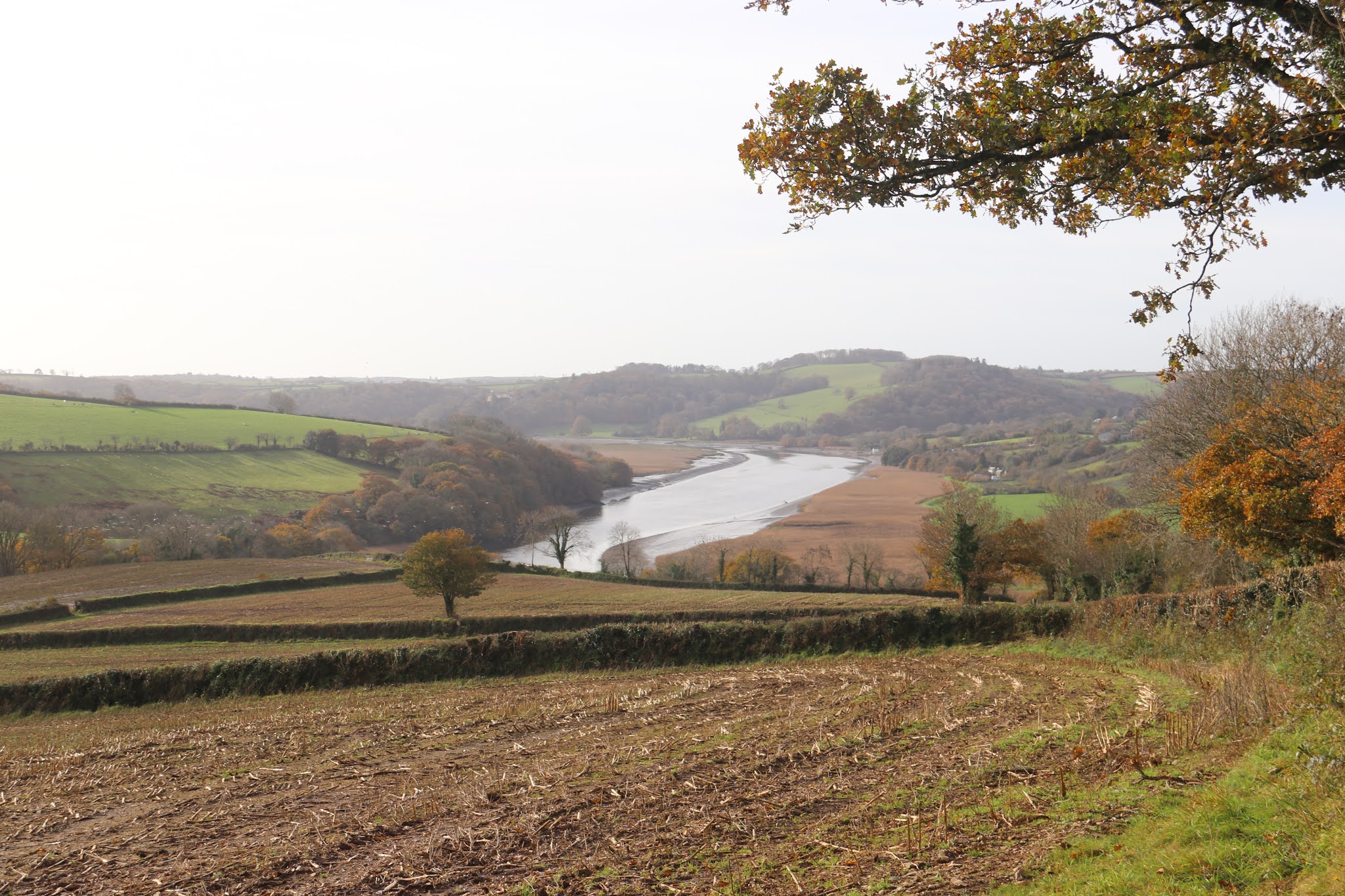
Our route started and ended in the car park at Bere Alston station (is it really almost 50 years since we used to occasionally catch a train from here into Plymouth?). We dropped down to the banks of the Tamar and then headed upstream to near Tuckermarsh Quay, to climb back up to the station. The elevation profile for the walk shows it quite nicely. Distance? I clocked it at 5.2 miles. As I said above, it was a delightful walk and took us through some quiet nooks and crannies' that we've never come across before.
The Tamar Valley service railway lines at Bere Alston station. As there's only about 6 trains a day, it wasn't too hazardous to get onto the track. The line to the left goes to Plymouth and that to the right heads for Calstock and Gunnislake. At Bere Alston, the driver gets out, gets into what was the rear of the train and then drives the train onwards.
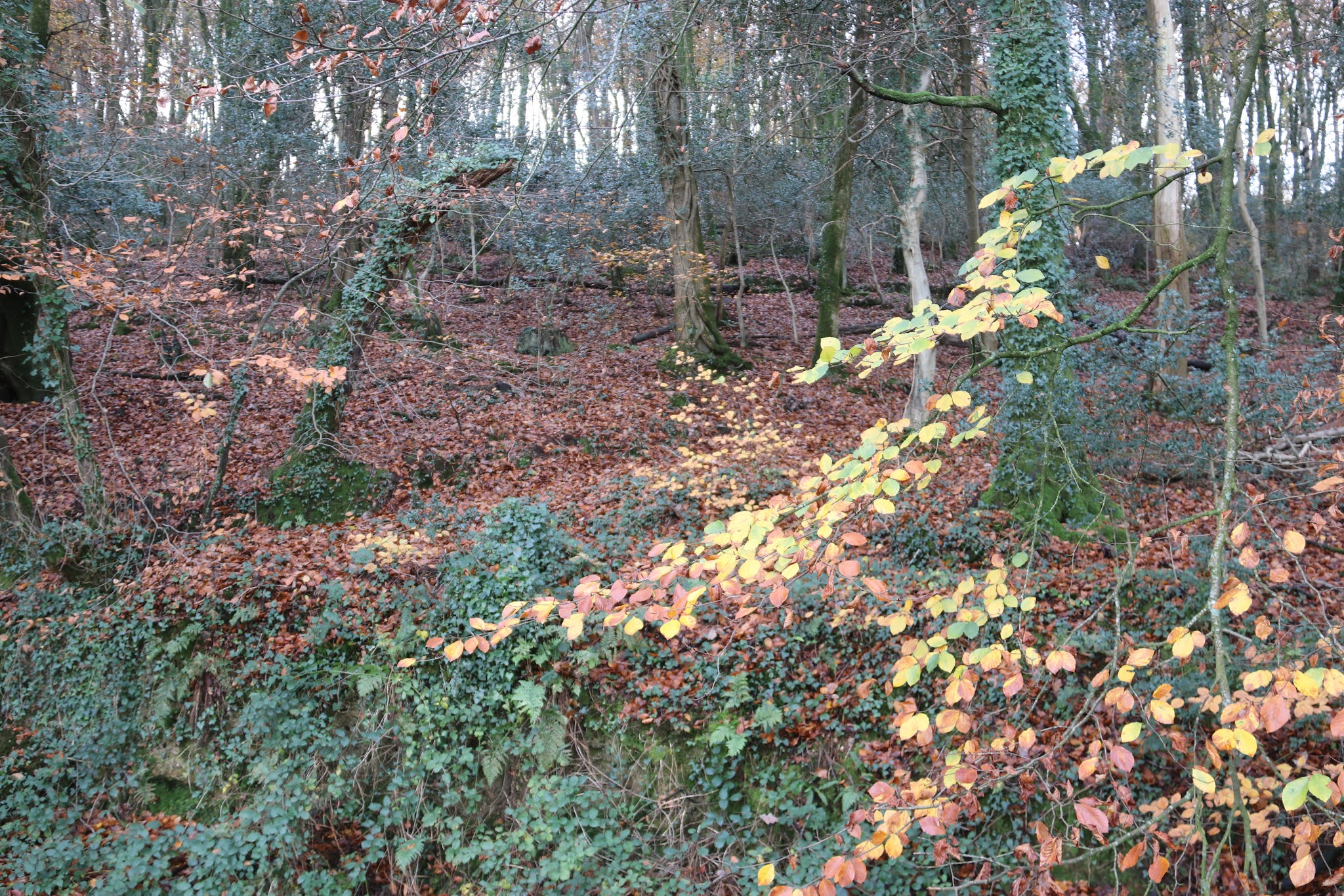
The leaf-strewn path by the side of the river. Very autumnal and very pleasant to walk on, with much rustling underfoot.
Looking downstream towards the Pentillie loop in the river. Not a view that we see very often as the 'other side' does not have any footpaths or roads.
It's a good year for holly berries. And fruit and nuts generally.
A leafy pattern - looking down.
Ditto - looking up.
Looking down the river from were we stopped for refreshments. It was so quite, just the lapping of the water and the call of a couple of buzzards circling above.
Looking across the river to the hamlet of Bohetherick. It's always had a lot of market gardens and, look carefully, you can see rows of Pittosporum bushes that are used as foliage plants for floral arrangements.
How many times have we been to the quay at Cotehele and looked across to where we are now? Too many to mention. At one time, I would imagine that there would have been a ferry acorss the river at this point.
Ahead of us is Danesombe Valley House. Originally built in the 1850s as a fishing lodge, it was a hotel for many years. Nowadays it's a family home, with spectacular views up and down the river. This photograph was taken whilst we were walking along the bund bordering the broad curve that takes the river into Calstock. Most of the leaves are off the trees on the Cornwall side.
Looking through the reeds across to Cornwall.
The river is to the left and we are walking towards the Calstock viaduct.
We rarely get to see the viaduct from this angle.
Although they may look like granite blocks, the viaduct is actually constructed of concrete blocks made on site on the Devon side.
The viaduct again with the old chapel to the right. It's now an arts' centre and has an amazing view from the main auditorium.
I think both versions of this shot bring something different.
The 3.30 train to Plymouth crossing the viaduct.
A metalled road is a road surface with small stones, possibly bound together with bitumen, tar, or whatever.. The word itself from the Latin 'metallum', meaning 'quarry'.  
A tapestry of colours in the woods opposite Calstock.
The sunken lane leading steeply down, and up, to Tuckermarsh quay, giving access to the Tamar for local produce from the Devon side. In parts, this trackway was carved out of the bedrock and the effort of doing this must indicate that it was important in its time. The coming of the railway probably saw the end of the use of  it.
Early Xmas lights at Bere Alston station.