A glorious afternoon and where better to walk than around Caradon Hill? It has it all: relatively easy walking, views all the way around and lots of industrial archaeology to pique the interest. And a personal connection to one of the mines. All this and a very nice tea room at the end!
Our route took us down the Gonamena Valley and around Caradon. Not too strenuous for the heat and around 3.5 miles.
It's been a wonderful year for May blossom and the display is just about coming to an end. But not quite. Spot the sheep.
Walking along the trackway of the Liskeard and Caradon Railway. It opened in 1844 and was built to carry the ores of copper and tin, and also granite, down to Moorswater, just outside of Liskeard, thence to Looe for transport by sea.
Although we have absolutely no propriety interest in this cottage, we have watched it fall into sad decay over the years and are delighted to see that someone is bringing it back to life. Originally 2 or 3 cottages for smallholders and dating from the late 1700s, it looks like their time has come again as a single dwelling. If there had been someone around, we would have asked about access and water and electricity supply. We can be quite nosey when we want to be.
The whole of Caradon Hill is surrounded by the evidence of mining. Here's the stack associated with Elliot's Shaft looming above the dumps of the West Caradon mine complex.
This is something we've never seen before. Known locally as the 'donkey pond', it acted as a reservoir and water supply to various water wheels associated with the nearby mining activities. In all of our time walking around here, it's never been completely dry. Assuming that there were similar periods of drought in the past, it brings home how dependent the mines were on water power. And with water, no work and no pay. Tough times.
And here we are at the most visible remains of South Caradon mine - the stacks and engine house associated with Rules and Holman's shafts.
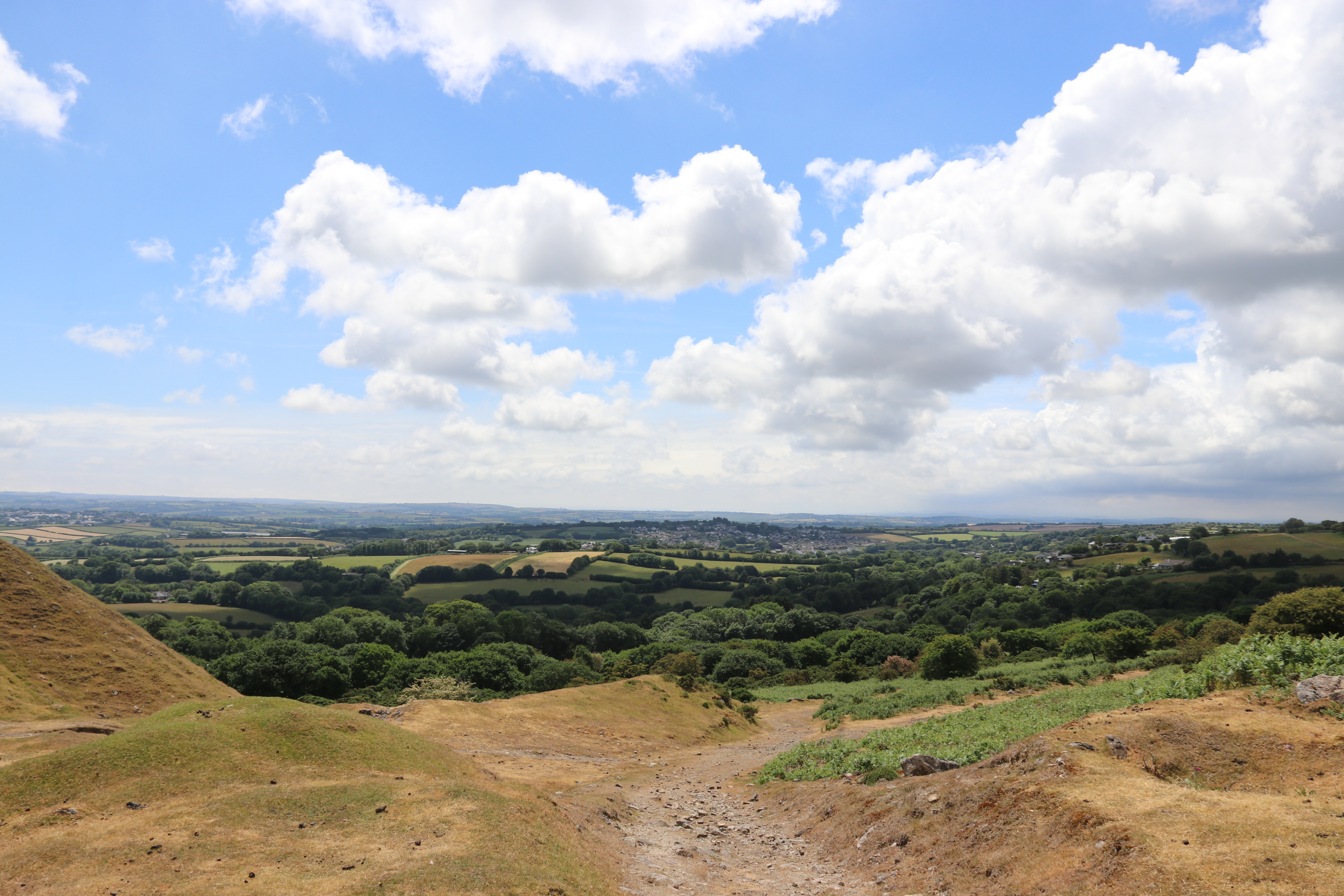
The view looking towards St Cleer and St Austell in the far distance.
Meadow Pipit.
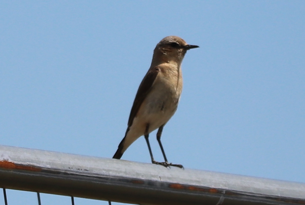
Wheatear.
Pied Wagtail.
An adit associated with the East Caradon mine, where Mrs P's great great uncle John Henry Cook worked before he emigrated to Australia to make his fortune. It is more likely to a drainage adit rather than a working level (see video below).
This is the main shaft (Pierce's Shaft) for East Caradon mine. It looks relatively benign now but there was a quite significant collapse of the walls to reveal a very deep pit a few months ago. It was thought to have been caused by the heavy rains at the time. It has been fenced off far more securely than it was before and, I believe, a local caving group has blocked up the hole with a barrier. This, I believe, is where John Henry Cook went to work.
This is the view from East Caradon mine, looking across to Pensilva and beyond. Is it fanciful to think that John Henry Cook might have enjoyed this very view in a moment of rest? Certainly, he would have walked into this view as he made his (weary) way home after a shift.
Descending from Caradon Hill, with Cheesewring prominent on the skyline, with Sharp Tor to the right. A panorama that captures the working industry of the area - granite workings on Cheesewring and near Sharp Tor - and the engine houses associated with the various mines. And here and there, you may be able to make out a few sheep/
I haven't been able to find a decent video of what the East Caradon mine looks like underground but this one does give a glimpse.
And on the grand scale, what about the myriad of shafts, adits and levels that made up the complex of mines around Caradon Hill? Keith Russ has been working on developing 3D computer models of all that lies underground. Take a look at the video that shows all that he has been able to trace and quantify. I think it's an amazing piece of research.
A good clear day and one just right for a walk! And this was a good one as it was our first longish walk after our bouts of Covid.
This walk came in at just under 6 miles in weather just fit for a walk. We started at Tokenbury Corner and took in the south of Caradon Hill towards the Gonamena Valley. Then down to Trevethey Quoit and Rosecraddoc Woods back to the starting point. We've done most of this walk before but usually in the other direction so it was interesting seeing it in reverse.
The tips on the right are from Kittow's Shaft, part of the South Caradon mine workings. In the distance are various mine stacks and engine houses connected with the West Caradon/Gonamena complex. Whenever I see these, I always remember that they were all produced by pick and shovel, with very little in the way of mechanical aids. What is seen is the result of a lot of hard physical labour underground in appalling conditions.
Looking towards the tips of the West Caradon complex.
Another view of West Caradon looking over the buildings associated with the Old Sump shaft. It really is a huge site. Mining began in 1839 but was largely over by 1874. By the 1860s, it employed over 500 workers.
Looking back towards West Caradon over what was once known as 'The Yard'. This was the area of processing and servicing the core of the operation, the shafts. Here there were the offices, miners' dries where working cloths were dried between shifts, tool sheds, wash houses and even a barbers. All gone now but once bustling with activity. Old photographs show that most of the buildings were plaster rendered and painted white.
A visit to Trethevey Quoit is always an awesome experience. Awesome because of its size and uniqueness. There aren't many like this in the West Country. It's a Neolithic (3500-2500 BC) 'dolmen' burial chamber, formed by five standing stones, finished off with a huge capstone.
Tomb or shrine? No-one knows for certain but that doesn't stop people from speculating. The weight of the capstone is estiamted to be around 20 tonnes and, however it was done, it was a feat of engineering getting it in position. Maybe a ramp was used but it would still require a lot of muscle power to pull it up a slope.
Taken from the information board for the quoit. It must have been an impressive and commanding sight when it was in its prime.
I just love the way that ferns gradually unfurl. We are fortunate to have the right conditions for them in Cornwall and they are everywhere. To think that we brought ferns down with us when we moved from Kent, where they did grow particularly well.
Bluebells in Rosecraddoc Woods.
The early months of every year are awash with a sequence of different colours - snowdrops, daffodils, camelias and bluebells. Of these, masses of bluebells are probably the most impressive. Here they are interspersed with the white of Wood Anemones. And the smell of the bluebells is just amazing.
An ideal spot for lunch - a curried lentil pasty, a cup of tea, sunshine and the sound of running water. Does it get any better?
Lots of Red Campion (Silene dioica) in the verges, field margins and woodlands at this time of year. A nice bright highlight. Also known as Adder's Flower and Robin Hood. Apparently they are a favourite of woodland fairies.
An isolated clump of Cowslips (Primula veris) on the verge of a lane at Lower Trethake. Synonymous perhaps with meadows and woodlands, I was surprised to spot it where it was. Unless I missed something, these were the only Cowslips we saw on this walk.
What I liked about this was the band of bluebells at the bottom of the bank. Thinking about it, it's not a surprise to see bluebells at the top and bottom - this is where the soil is. Despite the grass covering, the banks are really the traditional Cornish hedges of granite. Hardly conducive for bulbs.
A welcome watering spot for the many sheep on the moor.
And who doesn't like the sound of a babbling brook?
This post has been lurking unfinished for a few weeks but still worth putting it up.
As we were still in Covid incommunicado, mixing with too many other people was not on the agenda. But a Saturday Afternoon Stroll with Mrs P certainly was. So, it was off to Bodmin Moor. Just a few photographs for the record.
A circular route based on Minions and Caradon Hill, taking in the mines in the Gonamena and Marke Valleys. It worked out at 5.3 miles and was punctuated by tea and a snack at Trevallick's Tea Shop at Tokenbury Corner. We've done this walk many times but there's always something different to see.
On Xmas Eve last year, an electrical fault caused a fire that largely destroyed the Cheesewring Hotel at Minions. It's sad to see the building in this state but there are plans to rebuild and reopen. Another sad building is the one below called Pointer’s Piece, pretty much at the start of the walk. We’ve passed it many times and it is deteriorating more and more.
The start of the River Seaton that runs into the sea at Seaton, the Cornish version. It's all of 11 miles long and because it runs through a mining district, the water is polluted with traces of aluminium and copper, leading to smaller populations of aquatic wildlife, from insects to fish.
Granite blocks forming the sleepers for inclined plane of the Liskeard and Caradon Mineral Railway. This was operated on a counterweight basis. Note the vibrant green of the moss covered walls of the cutting.
A footpath doubling up as a stream. Not as bad as we have seen it and easy enough to avoid by balancing along the top of the wall on the left.
The tunnel next to the engine house at Holman's Shaft at the South Caradon Mine. It probably carried a track for trucks dumping spoil on the nearby tip.
Around Caradon Hill and now on the north west side - the engine house associated with the Salisbury Shaft of the Marke Valley mine. Abandoned in the 1880s and unsuccessfully reworked a few times since then. This site is in private ownership and who knows what the plans are for its conservation. It deserves to be as it is a fascinating area and one that is usually deserted when we go there.
Overlooking the Marke Valley site, with the Salisbury stack on the right and the Bellingham stack on the left. This time of year is a good time to potter around these sites because the ferns have yet to grow and obscure the more subtle features.
At the top of the Marke Valley and the stack and engine house associated with Jenkin's Shaft. Iconic features of the landscape in these parts.
We've done this walk many times and it never pales as it's got a little of everything. Panoramic views throughout and lots of history. This is an area that epitomises the 'boom and bust' nature of mining. The area we go through was, until around 1837, devoted to moorland farming and then, boom, minerals were discovered and many mines opened. The population exploded and settlements like Pensilva, Darite and Crows Nest were developed. Jump forward just fifty years and the mines were in terminal decline. Although they were in operation for a relatively short length of time, their impact on the landscape has been longer lasting.
This walk came in at just over 5 miles and was, as the map shows, a pretty straightforward circumnavigation of Caradon Hill. The route was, from the Hurlers Car Park in Minions, down the Gonamena Valley, around through the South Caradon mine complex to Tokenbury, then we follwed the lower arm of the railway to the Marke Valley complex, thence back up the Marke Valley to our starting point, with a slight detour to take in the Hurlers stone circle. All that with blue skies and no rain.
To keep costs down during construction, granite from the quarry at Cheesewring was used for sleepers on the original mineral railway rather than wood, which would have been in short supply in these parts. Although the granite sleepers were extremely hard-wearing, they had a tendency to shift slightly in the ground after heavy rainfall. This, in turn, buckled the tracks and led to frequent derailments and lots of maintenance.
Ponton's Piece, a pair of cottages that probably predated the railway. The outbuildings were used for stabling for the horses working the railway. One of these (cottages not horses) was occupied when we first walked these parts but decay has now set in and the roof is collapsing. If you look closely at the map inset, you'll see that this is incorrectly marked as 'Pontus Peace'.
Now this is what I call a 'retro-kitchen'. That dresser looks as if there's still some life left in it.
Still life with iron kettle, axe head and thermometer casing. An eclectic collection of artifacts.
At the end of each working day, the heavy, loaded carts would begin their steep descent, with a brakeman on each to keep their speed below the limited 12mph. In 1859, it is documented that there were 27 brakesmen working on the railway. As a mineral railway, the carriages were not legally allowed to carry passengers. However, realising there were plenty of keen sightseers, wishing to travel by rail up to see The Hurlers stones and the rock formations at The Cheesewring, the Liskeard and Caradon Railway quickly found a loophole. On Sundays, when the mines and quarries were not working, they would offer to carry passengers at no charge, but would charge them to transport their hats and baggage. These ‘free’ Sunday excursions were documented in the West Briton newspaper as early as 1850, and by all accounts continued into the 20th century.
This stack is associated with an engine that drove 'stamps' which crushed ore as part of the processing operation. In the distance, across the valley, is the stack associated with Eliot's Shaft in the West Caradon Mine complex. The valley floor at this point was a large flat, paved area called the spalling floor. Here large rocks from the mines were broken down into smaller pieces, initially with large spalling hammers and then into even smaller pieces with cobbing hammers. And then the broken pieces went on for further processing. At one time, this area would have been covered in some fashion. This was a very labour-intensive operation, especially when the ore was copper-containing. Large numbers of people would have been employed, including women and children. It's hard to imagine how busy this spot would have been and how noisy and smoky.
The stack at Rule's Shaft, with, fortuitously, a buzzard riding the thermals coming off Caradon Hill. The ruins of the pumping house associated with the stack are in the right foreground.
A tecnicolour sheep, either expressing support for the NHS or, perhaps, the local ovine members of the LGBTQ community.
A pumping engine house at the Marke Valley mine. It's not an area that we know at all and we'll have to return to get a better idea of how everything fits together. That this is a pumping engine house is evidenced by the remaining thick 'bob' wall upon which rested the main beam and evidence for a shaft on the other side of the wall.
One of the three remaining stacks on this site. My guess is that there is a large wheelpit in front of the stack and I'm thinking that this may have housed some winding gear for a nearby shaft. Of course, I could be completely wrong. We really need to go back with a decent site map.
The Salisbury Shaft, open and quite deep, with its associated pumping engine house to the left. Is it dangerous in this state? Of course. Should it be capped? Of course not. Should it have a more secure fence around it? Possibly, but I'm not too fussed about that. I've got a fairly relaxed attitude to these things. In a county with around 300 miles of dangerous coastline, the risks posed by a few holes in the ground are not something that excites or alarms me. I may be in the minority thinking this way but that's my view and I haven't fallen down one yet.
A buddle just downhill of Wheal Jenkin, the Marke Valley at the top of the valley. It was used for processing tin and was probably one of a series involved in the purification of tin.
This schematic shows how the buddle works. A slurry of raw material is directed towards the centre of the domed centre and this trickles down and particles sediment, according to how much tin they have in them. The heaviest, with the most metal, sediment out faster and closest to the centre. Lighter particles, with less metal, travel farthest from the centre and sediment out more slowly. To stop channelling of the sediment, a set of brushes, powered by a waterwheel, rotate and spread out the sediment. Depending on the make-up of the slurry, it may well take passage through one or more buddles to get material that was pure enough. Buddling in this way was an intermittent process as, at some stage, the sediment in each buddle had to be dug out; the high purity fraction retained and the remains removed and dumped.
A marker post that took us a while to decipher: MPBAW AM standing for Ministry of Public Buildings and Works Ancient Monument. It refers to the nearby Hurlers Stone Circle.
Walking back to the car with a lovely sky in front of us. An end to another very pleasant day.