Quid me anxius sum? (Alfred E Neuman, Mad Magazine circa 1956).
Facio, ita.
Wednesday, 14 June 2023
Sunday afternoon stroll around Caradon Hill
A glorious afternoon and where better to walk than around Caradon Hill? It has it all: relatively easy walking, views all the way around and lots of industrial archaeology to pique the interest. And a personal connection to one of the mines. All this and a very nice tea room at the end!
Our route took us down the Gonamena Valley and around Caradon. Not too strenuous for the heat and around 3.5 miles.
It's been a wonderful year for May blossom and the display is just about coming to an end. But not quite. Spot the sheep.
Walking along the trackway of the Liskeard and Caradon Railway. It opened in 1844 and was built to carry the ores of copper and tin, and also granite, down to Moorswater, just outside of Liskeard, thence to Looe for transport by sea.
Although we have absolutely no propriety interest in this cottage, we have watched it fall into sad decay over the years and are delighted to see that someone is bringing it back to life. Originally 2 or 3 cottages for smallholders and dating from the late 1700s, it looks like their time has come again as a single dwelling. If there had been someone around, we would have asked about access and water and electricity supply. We can be quite nosey when we want to be.
The whole of Caradon Hill is surrounded by the evidence of mining. Here's the stack associated with Elliot's Shaft looming above the dumps of the West Caradon mine complex.
This is something we've never seen before. Known locally as the 'donkey pond', it acted as a reservoir and water supply to various water wheels associated with the nearby mining activities. In all of our time walking around here, it's never been completely dry. Assuming that there were similar periods of drought in the past, it brings home how dependent the mines were on water power. And with water, no work and no pay. Tough times.
And here we are at the most visible remains of South Caradon mine - the stacks and engine house associated with Rules and Holman's shafts.
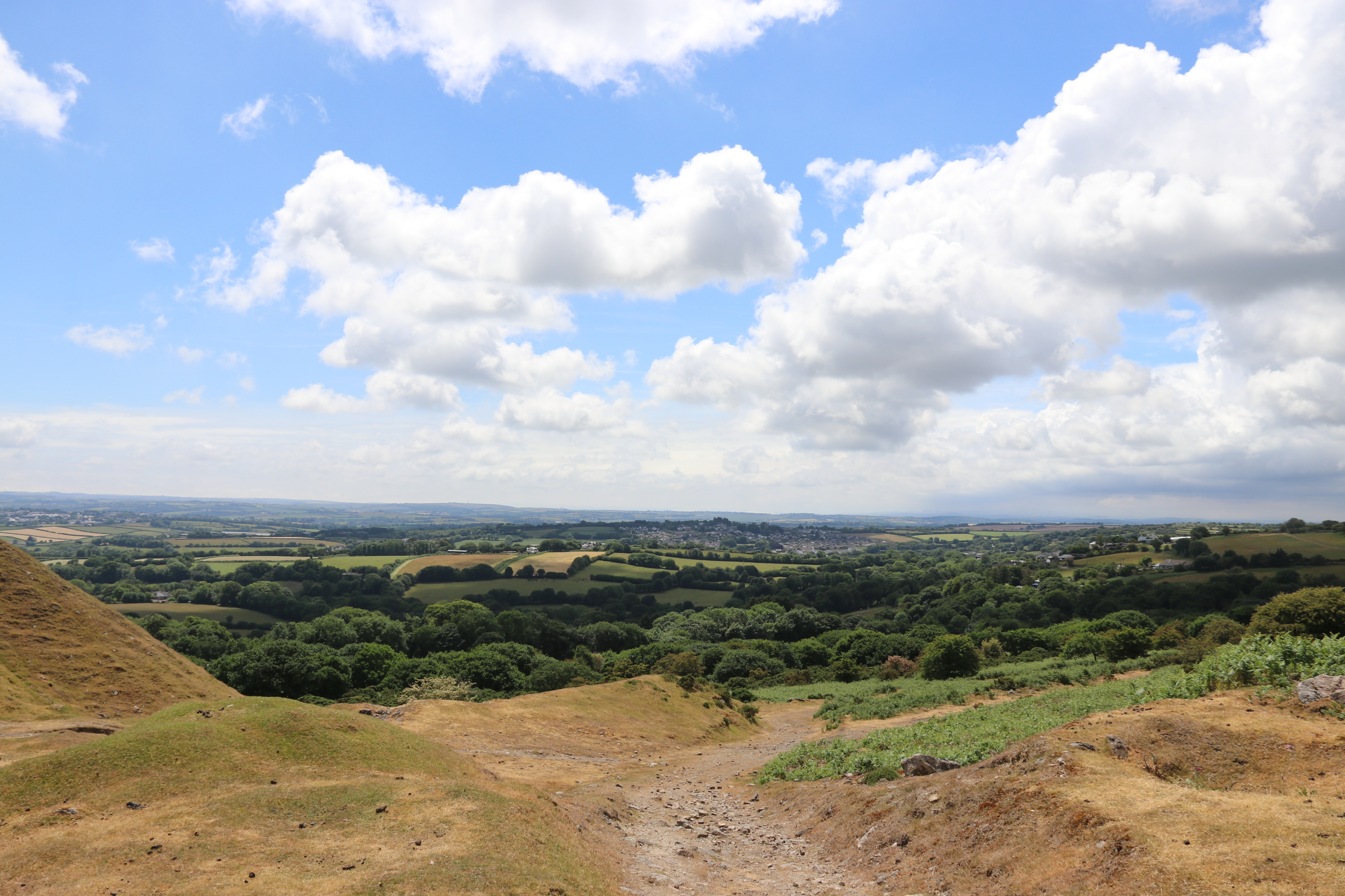
The view looking towards St Cleer and St Austell in the far distance.
Meadow Pipit.
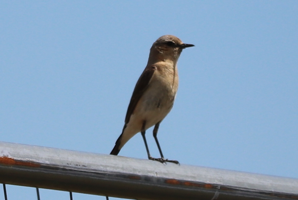
Wheatear.
Pied Wagtail.
An adit associated with the East Caradon mine, where Mrs P's great great uncle John Henry Cook worked before he emigrated to Australia to make his fortune. It is more likely to a drainage adit rather than a working level (see video below).
This is the main shaft (Pierce's Shaft) for East Caradon mine. It looks relatively benign now but there was a quite significant collapse of the walls to reveal a very deep pit a few months ago. It was thought to have been caused by the heavy rains at the time. It has been fenced off far more securely than it was before and, I believe, a local caving group has blocked up the hole with a barrier. This, I believe, is where John Henry Cook went to work.
This is the view from East Caradon mine, looking across to Pensilva and beyond. Is it fanciful to think that John Henry Cook might have enjoyed this very view in a moment of rest? Certainly, he would have walked into this view as he made his (weary) way home after a shift.
Descending from Caradon Hill, with Cheesewring prominent on the skyline, with Sharp Tor to the right. A panorama that captures the working industry of the area - granite workings on Cheesewring and near Sharp Tor - and the engine houses associated with the various mines. And here and there, you may be able to make out a few sheep/
I haven't been able to find a decent video of what the East Caradon mine looks like underground but this one does give a glimpse.
And on the grand scale, what about the myriad of shafts, adits and levels that made up the complex of mines around Caradon Hill? Keith Russ has been working on developing 3D computer models of all that lies underground. Take a look at the video that shows all that he has been able to trace and quantify. I think it's an amazing piece of research.


No comments:
Post a Comment