 |
| The moon the previous night was, if not blood red, definitely pink. Try as I might, I could not get a faithful reproduction of its colour but this one will give you the gist of what it looked like. |
 |
| On the ferry from Laxo to Symbister on Whalsay and this is the one going in the opposite direction. Each crossing takes around 30 minutes and they are scheduled to run approximately every 45 minutes or so. Turn up 5 minutes before they go and, if there's space, you'll get on. And, guess what? those over a certain age get tickets that are very generously discounted. IF I remember correctly, the fare for a car and five passengers was £13 return. Bargain. |
 |
| Whalsay is off the east coast of Mainland Shetland and is roughly 5 x 2 miles. Its main industries are fishing and crofting and its population is just over a thousand people. For hundreds of years the local salt fish trade was in the hands of German merchants of the Hanseatic League. Ships from Hamburg, Bremen and Lubeck sailed to Shetland, particularly Symbister in Whalsay, every summer, bringing seeds, cloth, iron tools, salt, spirits, luxury goods and hard currency. Generations of the same families made the voyage and some merchants are buried in the islands. But it all came to an end when the Germans were forced out by import duties after the 1707 Treaty of Union between England and Scotland. Problems with Europe and import duties, eh? Doesn't that have a modern echo! |
 |
| Once on the island we headed in a northerly direction (in fact, the only direction as there is but one decent road). In many places we came across these stone circular structures, not always by a loch - they seemed to be everywhere. We wondered if they were animal pens but found out that they were called 'crubs' locally and 'planticrubs' elsewhere on Shetland. They were, if you like, stone cloches to help raise plants by protecting them from the elements, prior to them being transplanted to their final quarters. How old are they? Something like this has been around for centuries. Sometimes they are covered in nets to keep birds away. To come completely up-to-date, what we call poly-tunnels down south are called poly-crubs on the islands. |
 |
| Whalsay Golf Club and, as the sign says, it's Britain's most northerly golf club. An incredibly friendly and obliging member allowed us to use their toilets and kitchen facilities, even though the clubhouse was closed. I had an interesting chat to their part-time green keeper who had moved north from Cornwall a few years ago. He obviously loved the relaxed way of life up here and was glad to get away from the hordes of tourists that swarm over his home county during the summertime. |
 |
| From the Golf Club car park, we did a 5-ish mile walk around Sponger Point and Skaw Tang. A classic sea shore walk with a few cliffs on the eastern side. In essence, we walked around the edge of the golf course. I think if I were a golfer playing here, I would find the views very distracting. But that may be a useful excuse for ineptitude! |
 |
| The bay of Peat Geo, with a raft of gulls. At least three variants: Black Backed, Common and Herring. |
 |
| The channel between Whalsay and the small island of Inner Holm of Skaw looks like it has some treacherous currents. A golfing hazard? |
 |
| Typical of the scenery we encountered on our walk. Here's a thing that puzzled me as we went around. I know that golf courses have 'out of bounds' markers but is it really necessary to put markers next to the cliffs? Aren't they obviously out of bounds to all but the most adventurous (or foolhardy) golfers. And another thing: we wondered how many balls were lost because of the prevailing winds. |
 |
| Given the frequency of flights to Whalsay - one every now and again - walking up the centre of the landing strip posed absolutely no hazard. |
 |
| Lots of Turnstones around, showing their breeding plumage, although they only breed in the Arctic and are migratory in most parts of the UK. They are also known as Ruddy Turnstones because of their reddy-brown colouration. |
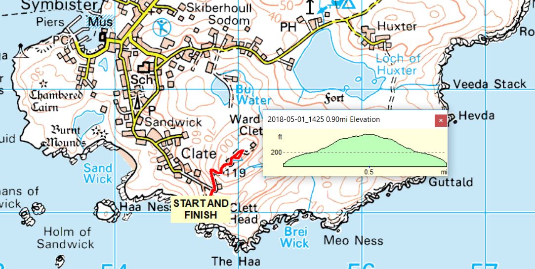 |
| On our way back to the ferry, two of us walked up to the highest point on Whalsay, Ward of Clett. |
 |
| At the top we came across Trig Point 10523. Not your standard Hotine pillar but a Vanessa - a circular design seen in some sites in Scotland and Northern England. The standard pillar took about a ton of material to build and the Vanessa was introduced for the more inaccessible places in order to lessen the burden for the builders. 'Vanessa' is thought to be a corruption of 'Venesta', the firm that made the cardboard formers that were used. Venesa was chosen because they were manufacturers of toilet rolls, in a way the mini-version of the Vanessa. |
 |
| Near the trig point were some long-abandoned military buildings (telecommunications of some sort. Why, oh, why can't the military clear up after they've left a place?). On the floor of one was this rather impressive piece of graffiti, although the term may be denigrating the effort that went into drawing it. It crossed my mind that it may be ritualistic in some way. |
 |
| The Whooper Swan is a large white swan, bigger than the Mute Swans we see down south. It has a long thin neck, black legs and its black bill has a large triangular patch of yellow on it. It is mainly a winter visitor to the UK from Iceland, although a few pairs nest in the north. |
 |
| Looking back to Symbister on our return journey. Like many such communities in Shetland, it was rather spread out. That large boat is one of the fishing fleet that still works out of the hardour. |
 |
| Will ye no come back again? Maybe, one day. Look out for me. |
No comments:
Post a Comment