 |
| The route we took was a circular one starting at Nosworthy Bridge, at the top of Burrator Reservoir, out on the moor to Crazywell Pool and then back along the Devonport Leat. Lots of views and lots of interesting features. At just over, 4 1/2 miles, it was a good way of spending 3 hours (including stops!). |
 |
| Up on the track looking back towards Burrator. Sheep's Tor is to the left and, in the far distance, is Kit Hill. And not a virus in sight. |
 |
| Crazywell Cross is probably one of a number of crosses that marks the route of the Monks’ Path. This is the ancient name given to the track that links the Buckfast Abbey with those at Tavistock and Buckland. No-one is entirely sure which course the path took to the West of Nun’s Cross. However, considering the number of ancient crosses on this track it is perfectly feasible that it passed this way, via Walkhampton, to Tavistock and Buckland. It's also used as a rubbing post for cattle. |

 |
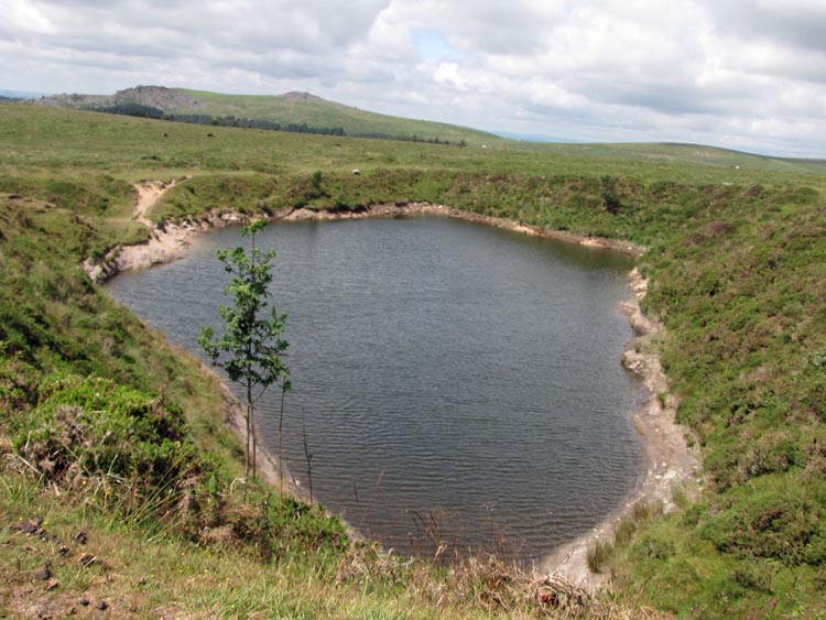
| The pool is also used by wild swimmers. It's cold and these few did not stay in that long. Faint hearts! Am I tempted? Not in a million years. But it is a great place to sit and contemplate the scenery. |
 |
| Just up the hill from Crazywell Pool we come across the Devonport Leat. This was started in the 1790s to provide water for the ever expanding dockyard and town of Devonport. Apparently when it was being planned, approaches to Plymouth Town Council to share water from Drake's Leat were rebuffed. Devonport Leat takes its water from a number of sources and is generally accepted to be around 27 miles long. Overall, it has a gradient of 1% which is an incredible feat of surveying and engineering. But there's more to the gradient that a simple %. It was calculated so that the flow was not slow enough to cause silting and not fast enough to cause erosion of the banks. It really was clever stuff. |
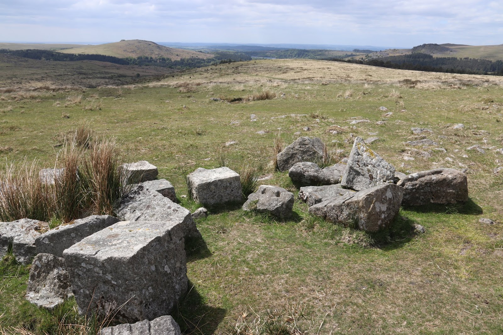 |
| At several places along the leat were piles of obviously carved and shaped granite. Look closely and you'll be able to make out drill holes. What were they for? The leat was originally built as a trench and was later lined in places with blocks to prevent leakage. I think these blocks were destined to be used as liners but, for some reason, these were spares. |
 |
| Every so often, the water is controlled by a sluice. And by each sluice is an overflow. In this case, the overflow channel is seen just to the left, in front of the sluice. |
 |
| And what happens to the water so diverted? Perhaps to 'feed' a farm or homestead? In this particular case, |I think it was diverted into a 'gert' to wash topsoil off to give tinners easier access to the underlying tin-containing strata. What is a gert? It's a deep, open tin working that is considered larger than a gulley, they are sometimes also called 'guts'. The left and right boundary banks of the gert in the photograph are clearly visible. |
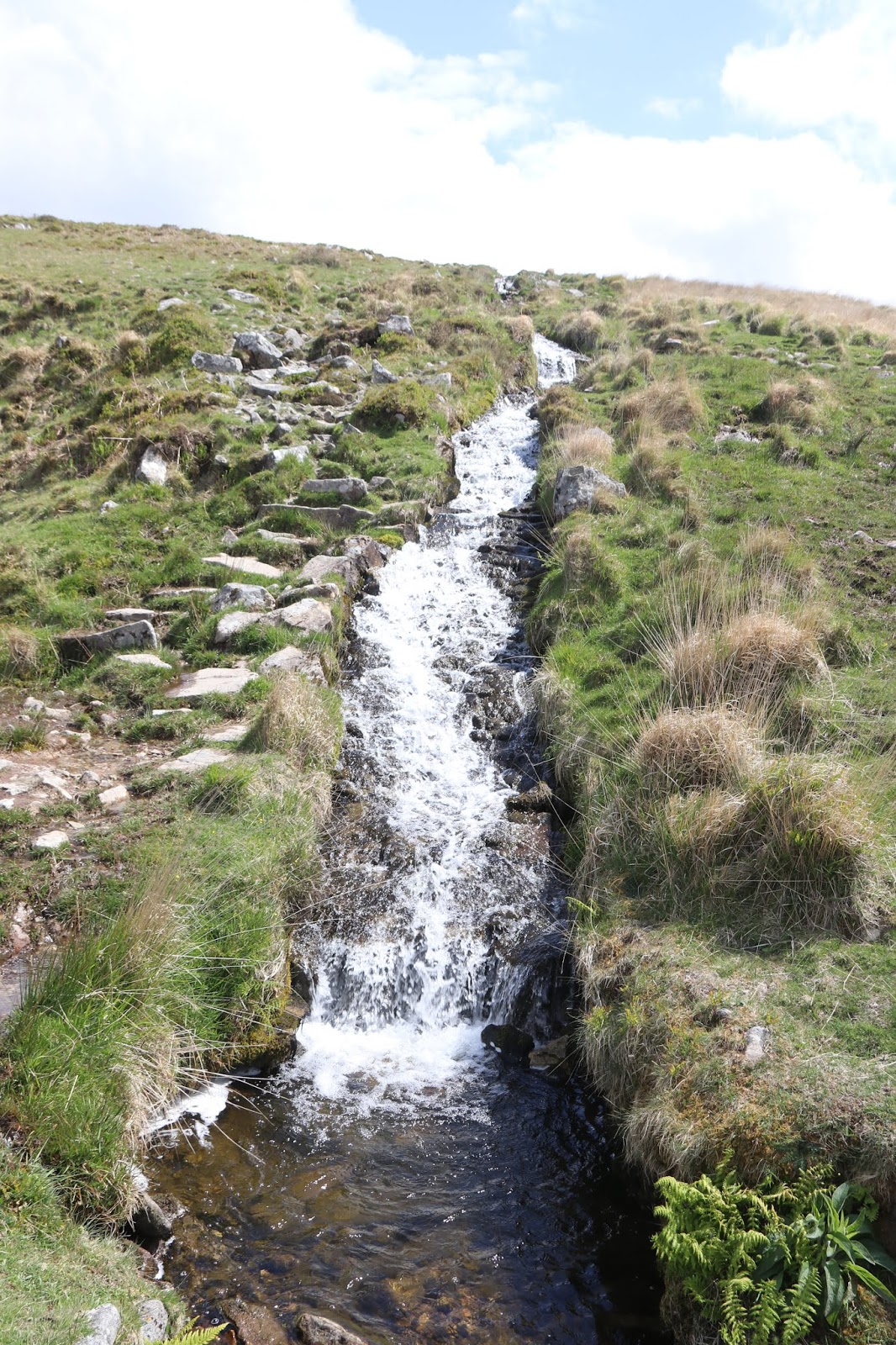 |
| The Devonport Leat remains more or less level throughout its course except where it drops down Cramber Tor into the valley of the River Meavy. Known as the Devonport Leat Falls, or the Raddick Falls, the leat having descended the hill flows over a metal aqueduct known as 'Iron Bridge' and then turns towards Plymouth as a 'normal' leat. The metal aqueduct replaced the original wooden launder that took the leat over the river. Why, you may ask, was water in the leat taken from so far away when the Meavy was so handy? The answer is simple: the water of Drake's Leat was abstracted from the Meavy and the City Father's of Plymouth would have been less than pleased if their water had been purloined for those upstarts in Devonport. |
 |
| Is there anything more calming than the sound of running water? |
 |
| The ruins of Leathertor Farm. It was first mentioned in 1362 and last occupied in 1924. The last tenant sold out to the Plymouth City Water Works prior to the expansion of Burrator Reservoir. This was the common fate of several farms in the area because of the possibility of farm activities contaminating the water supply. The buildings are being allowed to decay naturally as the buildings are not unique enough to warrant active conservation. |
 |
| Just down the track towards Leather Tor Bridge, we came across this man-made vooga (fougou) or potato cave. It would have been used for storing root crops, including potatoes and swedes - no doubt for their pasties! An alternative explanation is that it was a sort of tool shed. Nowadays it is blocked off in season to allow Horseshoe Bats to roost. |
 |
| Leather Tor Bridge. Walkhampton Parish Council decided on 20th June 1833 to build a bridge over Riddipit Stream at this spot (this is the site of the Riddipit Steps stepping stones crossing place). At the next meeting the following month (25th July) it was resolved to accept a tender from George Worth and Wm. Mashford for £26.10s. The seven stepping stones of the old Riddipit Steps are still to be seen, four in situ and three displaced by floods. Alongside the steps is the even older, overgrown ford. Apparently, this was the last clapper bridge to be built on Dartmoor. Some writers claim that this bridge is a lot older but the fact that clinches the date is the presence of drill marks on some of the slabs of granite. This technique did not come in until the early 1800s. |
 |
| An infra-red image of Down Tor. Not sure that it adds anything special to it. |
 |
| And an IR of Crazywell Pool. |
1 comment:
Fascinating about the waterway. Great pictures as well
Post a Comment