 |
| This photograph of a local resident gives a clue to where we went for our recent Sunday afternoon stroll. The Marmite of birds - love them or hate them, they are very hard to ignore in any Cornish seaside town. |
 |
| As we had to be in Looe for something else, we thought we'd take advantage of this and go 'up river' and through the Kilminorth Nature Reserve that runs along the bank of the West Looe River. It was only 3 miles but, as the profile shows, it did have a fairly long and very steep stretch. A good muscle stretcher and lung tester - we survived to tell the tale. |
 |
| In the middle of all that mud is the West Looe River, with some houses of West Looe in the distance. Just in case you are wondering, the West Looe River is not so named because it runs to West Looe, neither is the East Looe River named because it runs to East Looe. In fact the West and East arms of the Looe River join just before it runs between East and West Looe. Got it? Lots of mud means lots of mud loving birds. |
 |
| A Little Egret. Not that long ago, people would have driven miles to see a Little Egret as they were quite rare. Nowadays, they are becoming quite commonplace and, on this walk, I must have seen twenty or more. |
 |
| The plaintive cry of the Oystercatcher always reminds me of Orkney and/or Shetland where they are as common as Sparrows. Down here, they are infrequent but not particularly rare. They do love a bit of mud to poke around in. |
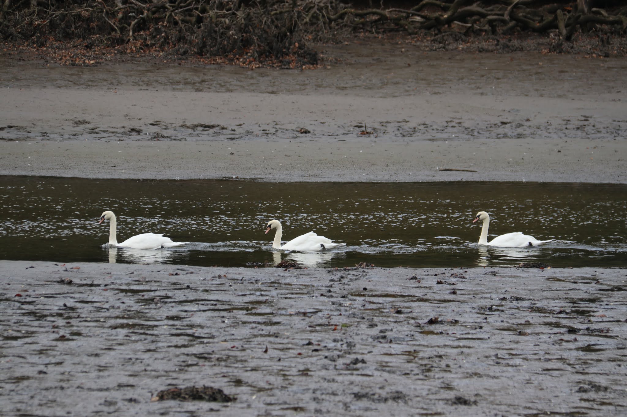 |
| The only word to describe how swans move is 'gliding'. A trio of swans gliding up the river with the incoming tide. |
 |
| Interpretation boards for Kilminorth Woods have this short rhyme: Jack the Giant Having nothing to do Built a hedge From Lerryn to Looe What's that about? In a variant of the rhyme, Jack is replaced by the Devil. |
 |
| The Hedge - the Giant's Hedge - is a earthen bank which runs from Looe to Lerryn, a distance of approximately 12 miles. There's a stretch of it in the photograph to the right. Along its length, it's in various states of repair (or disrepair) and at its best preserved is around 2 m high and 3.5 m wide. It passes through four different parishes and appears to have been constructed to defend the area between the Rivers Looe and Fowey. It was considered it to be a Roman road but it is now believed to be a pre-Norman boundary. How much pre-Norman? Perhaps dating back to 3000-2000BC? |
 |
| Looking over the trees and above the river valley. In the distance, you may be able to make out the stack on the top of Kit Hill. |
 |
| Looking over a sea of broccoli towards the real sea and East Looe. Rame Head is in the far distance and increasing the magnification of the image makes the Eddystone Lighthouse discernible. At this point, it must be 25 miles away. |
 |
Kilminorth Woods forms one of the largest valley oak woods in Cornwall. The area has been continuously wooded for at least 400 years and is classified as a semi-natural ancient woodland. Semi-natural rather than natural because coppicing took place for much of that time, artificially extending the life of the trees by many centuries. In coppicing, young trees are repeatedly chopped down, leaving a stump which produces thin branches to be harvested for brushwood, poles or firewood. In due course, when these branches are lopped, the process begins all over again. It keeps a tree in a juvenile condition, meaning that a regularly coppiced tree will never die. Since coppicing is carried out in rotation through a woodland, the trees throughout are of many different ages, which provides a diversity of habitats for a wide range of species. |
No comments:
Post a Comment