October 9th 2021 - a very special day. It's our wedding anniversary. Well, sort of. Mr Google tells me that it's been 18,809 days since we walked up the aisle at St Mary's in Risca. Surely a cause for celebration and where better to be festive than Dartmoor? And where better than somewhere we haven't been before - the Trowlesworthy Warren area.
 |
| We parked near Cadover Bridge, that well known honey-pot for the good people of Plymouth, and headed up the track to Trowlesworthy Warren House. From there, we went onto the open moor and wandered through the collection of settlements on the side of the tors. We then ascended the slope to the tors and finally dropped down to the Plym, parallel to Spanish Lake (not a lake, but a stream). At around 4 miles, it was a good Saturday afternoon excursion. |
 |
| And that’s where we were heading - Little Trowlesworthy Tor to the left and Great Trowlesworthy Tor to the right. |
 |
| A glimpse of the River Plym as we set off. |
 |
| A fine collection of abandoned and rusting vehicles at Trowlesworthy Farm. There has been a farm here since pre-Domesday Book and it looks as if some of the old tractors date from around then as well. The associated rabbit warren is generally accepted as the oldest warren on Dartmoor and has mediaeval origins. Within the boundaries of Trowlesworthy Warren are around 64 pillow mounds and 40 vermin traps scattered along the slopes of Little and Great Trowlesworthy Tors. The borders of the warren are defined by the natural rabbit defying waters of the River Plym, Spanish Lake and Blacka Brook. |
 |
| We came across the Lee Moor China Clay Leat several times. It runs from its take-off on the Plym to the 'Big Pond' and is approximately 2 miles long. It was built to serve the China Clay quarries, possibly as early as 1809. Interestingly, it incorporates many narrow foot bridges over Trowlesworthy Warren and these are thought to have been placed to accommodate the rabbits of the warren. All such leats are a testament to the fact that, although there is plenty of water on Dartmoor, sometimes it takes a lot of effort to get it to where you want it! |
 |
| A rather magnificent cloud formation over Great Trowlesworthy Tor. |
 |
| On the slopes of the Trowlesworthy tors are many buildings and structures which form a complex multi- period archaeological landscape, starting with the Bronze Age. The stone hut circle settlement complex is probably the most extensive we've come across on Dartmoor and includes at least 19 enclosures and 37 stone hut circles. |
 |
| Just two more of the hut circles. They really are substantial affairs and very impressive. It was good to sit amongst them and to savour the tranquility. It is hard to imagine it 3,500 years ago dotted with settlements of neat round huts, with fields of crops growing near the river and herds of pasturing animals on the higher slopes; or, in mediaeval and later times, alive with the activity of rabbit farming and tin streaming. |
 |
| An aerial view of the settlement areas. The circular boundaries and the hut circles are quite easy to make out, as is the dark line of the China Clay leat. |
 |
A Bronze Age stone circle just passed, and probably contemporaneous with, the stone settlements. There are eight stones in the circle and, unlike many, has not been 'restored' by any well-meaning, but ignorant, Victorian archaeologists. As ever, no-one knows its original function but we'll have to accept 'ceremonial' as a description. My alternative suggestion is that it was a place where Bronze Age teenagers could hang out and do their thing away from censorious eyes at the settlement. |
 |
Leading away from the circle are two stone rows, about 300 yards apart. They are a single row of about 50 stones running east to west and a double row (featured) comprising of over 100 stones, running north to south. At the head of each row, there is a stone cairn. Function? Again ceremonial and/or processional. Although it strikes me that it would be great fun weaving in and out of the stones on a Bronze Age scooter or mountain bike. Who knows? |
 |
| In the distance are the China Clay workings that have been a feature of this part of the moor for centuries. In the mid-ground, you can make out the leat as it enters the final stages of its journey. Some find the dumps intrusive, I just accept them for what they are. Probably a view shaped by the many coal tips of my early years. |
 |
| The impressive granite outcrop that makes up Great Trowlesworthy Tor. Mrs P leads the way. |
 |
| Once around the tors, it becomes very obvious that they were quarried extensively and were particularly active in the early to mid-1800’s when the Pink Granite was extracted straight from the sides of the Tors. The Pink Granite was much valued because it was durable and could be polished to give a very attractive finish. |
 |
| The spoils of the quarries are clearly visible all over the place and there are many artefacts lying around....... |
 |
| ...........the most distinctive, and curious, of which is a rather large granite cylinder over 5 foot across. Apparently, back in the 1820s, there was a scheme to erect a large flagpole in Devonport (some say to indicate its independence from Plymouth) and a cylinder of granite was needed for its base. Here, at Trowlesworthy, a suitable boulder of Pink Granite was found and the stonecutters set to work shaping it. Unfortunately, by the time they had finished, the project had collapsed and it was surplus to requirements. So, for nearly 200 years, the cylinder has remained here, waiting for someone to find a use for it. |
 |
| The China Clay leat again, contouring around the tors. The cleave you can just make out is where Spanish Lake runs. Why Spanish? Why Lake?Lake - simply because Lake is synonymous with stream, brook etc in this part of the world. Spanish - legend has it that it is connected with the threat of invasion by the Spanish as part of the Armada. Local residents hide their valuables in the peat hereabouts and waited for the threat to subside before retrieving them. But, did they? Another legend says that they didn't and that there's a fortune to be found, deep in the peat. Another good reason for watching where you tread? |
 |
| My curiosity was piqued by this red bow tied around a branch of this hawthorn tree. Given the steepness of the bank, it would not have been an easy thing to do. Someone was very determined. A route marker perhaps? |
 |
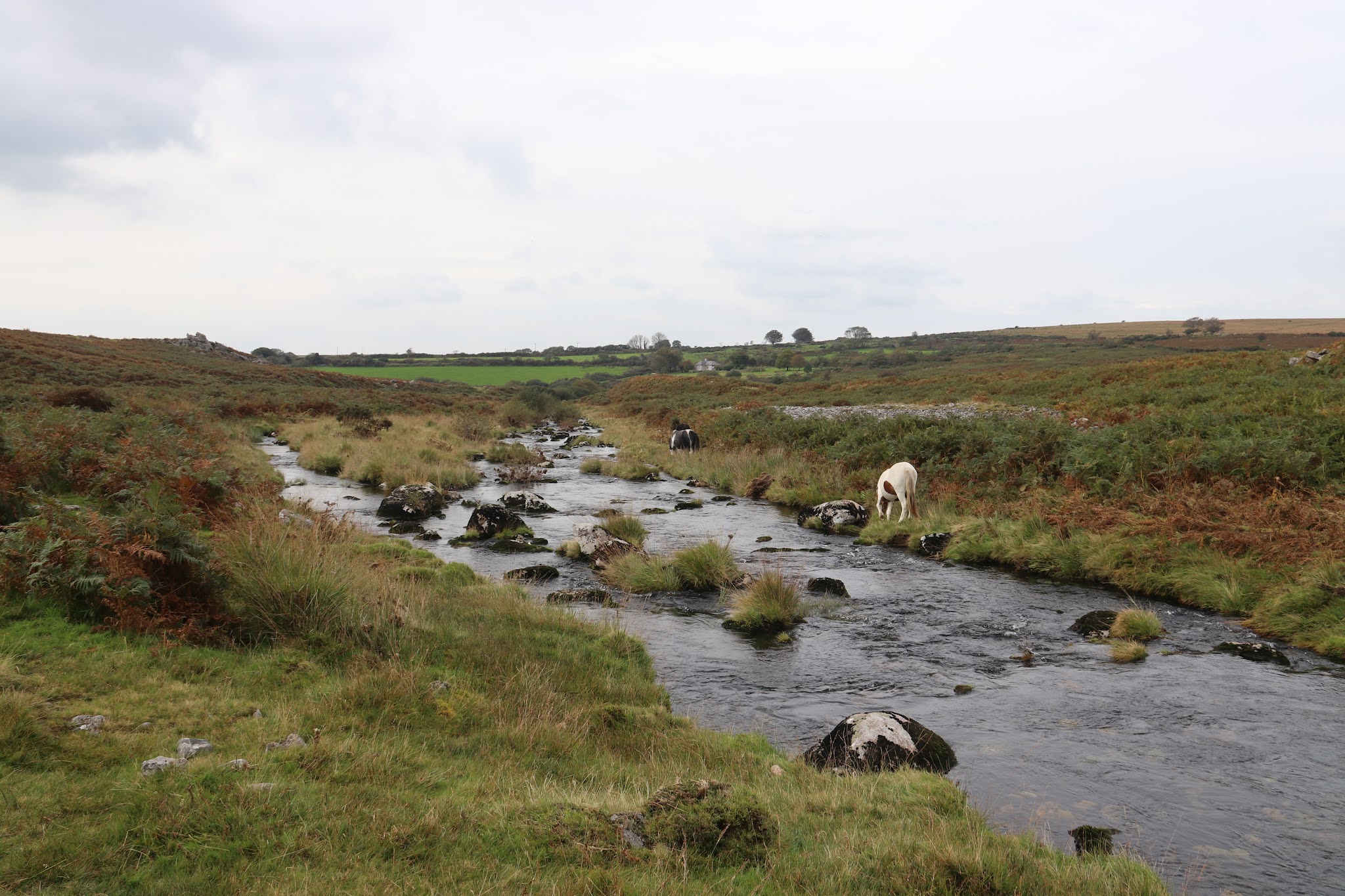
| The last half mile or so of the walk took us along the banks of the Plym, which was, rather surprisingly given our recent weather, rather tame. Look closely as you walk here and you’ll see lots of evidence of tin mining. |
And for those who like the sound of running water, here’s a rather docile Plym. And it’s October 10th now, our 18,810th day anniversary. I’ll celebrate by making Mrs P a bowl of porridge.


No comments:
Post a Comment