It was a day of contrasts, from relatively warm weather when we walked in the Kodachrome Basic State Park through rain and finally heavy sleet as we negotiated Boulder Mountain. It was a route well worth taking as it took us through amazingly varied landscapes and majestic scenery - forgive the hyperbole but it really deserves it.
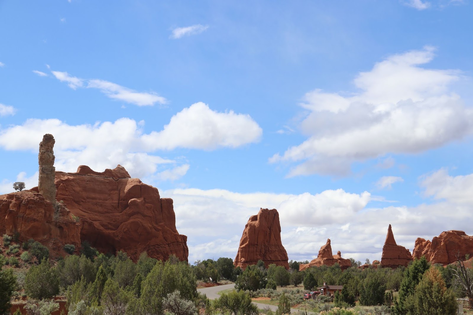 |
| Red rocks in Kodachrome Basin State Park. These are not hoodoos but stacks and pipes. There were very few people around. This place reminded me of the terrain of so many of the westerns I used to watch at the 'flicks' a long time ago. |
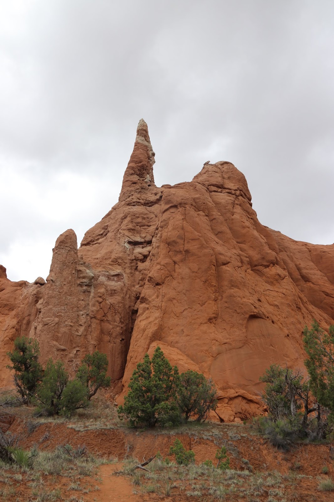 |
| The red rocks are endlessly fascinating - to me, at least. |
 |
| Here's something unusual - dinosaur tracks in the rock going vertically up the rock face. A dinosaur only found in these parts apparently - Dontbelievicus Aworditicus. |
 |
| The rocks are very soft and get washed away quite easily. You can see the tracks of dripping mud quite clearly everywhere. it's like wax dripping from a candle. |
 |
| To give an idea of the size of the rocks, here's Mrs P at the base of one of the cliffs. The walking was easy and underfoot was red sand washed down off the rocks. I presume that, after a downpour, the place is pretty much a sea of red mud. |
 |
| Up a blind alley? Actually, no. It's up a slot canyon - a narrow canyon off a bigger one. Got to get the terminology correct. |
 |
| I'm almost encouraged to pick up a geology text and find out more about the formation we are seeing. But, who am I kidding? I won't so I'll rely on the inforamtion boards we come across as we go around. |
 |
| This is called Face Rock. I don't see it myself. |
 |
| This State Park is reknowned for these pipes, which are basically stacks of harder rock than the surrounding red. It's not clear how they were formed but one theory suggests that they may have originated as 'vents' in the earth's crust becoming filled with the hard rock. The softer rock around was eroded over the millenia leaving the filled vent as a pipe. Seems reasonable to me but what do I know? I haven't read the book. |
 |
| A little bit of retro nostalgia by the roadside in Canonville. I remember Mr Rogers in Bedwas having one like this in the mid 1950s. |
 |
| I said we passed through some magnificent scenery. Here's one example of many. |
 |
| And another a few miles on. All very distracting for the driver! |
 |
| The further east we drove, the more the scenery changed. This landscape was taken as we drove 'The Hogsback', described as a road over 'a thin razorabck ridge of slickrock'. It is very steep either side but no worse than we've encountered in various parts of Europe. Not quite the white-knuckle experience I was expecting. This road was completed in 1940 and was the first all-weather connection between the communities of Boulder and Escalante. The description of how the road was built, largely by blasting with dynamite and removing the debris by horse and hand, is a testament to hard work and determination. |
 |
| We stopped in Escalante and asked where we could get a drink and a snack. "Try the Kive Koffee Shop. It's only two miles down the road". At least 20 miles later, we came upon it and, as our informant had told us, there were "million dollar views" and a 9 dollar Turkey Sandwich. Cheap the US isn't. And don't get me started on the "we respectfully suggest a service charge of 18%" appended to every bill. |
 |
| This is countryside for those who like hiking. Lots of trails and lots of places to head for. If you want historic houses, gardens and museums, this isn't where you want to be. |
 |
| The slickrock formations are typical of this area and stretch as fas as the eye can see. As a point of interest, the Fremont Valley wilderness, which is where this photograph was taken, was the very last part of the USA to be surveyed. It wasn't properly mapped until around 1870/1880.I've been looking for trig points but haven't seen any. I must ask Mr Google about these sometime. |
 |
| Snow on Boulder Mountain. Well, it was at nearly 10,000 feet. |
 |
| Low cloud over where we'll be trekking tomorrow. The weather forecast suggests that we should be putting our winter woolies on. |
 |
| Guess who joined us for dinner? I know all about his homophobic, mysoginistic, anti-libertarian, gun-toting views but his films were the backdrop to my growing up. John Wayne and the Bedwas Workingmens' Hall are extremely unlikely bed fellows. |
No comments:
Post a Comment