 |
| We started and ended in the Hurlers car park at Minions. It was a 6.8 mile circular route taking in Craddock and Twelve Men's Moors, plus a couple of tors and some stretches on the old mineral railway. The track is the green one in the inset above, which also shows the many walks we've done in this general area. We are starting to know it quite well and we never get bored with the scenery. It's always different. |
 |
| A solitary engine house on the way to Treggarick Tor. It was surrounded by lots of evidence of the mining activities that took place there in the mid 1800s, with some features that looked like they pre-dated this period. |
 |
| On the side of Tregarrick Tor looking northwards with Brown Willy and Rough Tor in the far distance. They'd be about 20 miles away, as the crow flies. |
 |
| Clouds over Tregarrick Tor. It was not a day for clear blue skies and the cloud formations were with us all the way around. |
 |
| Ooh, look! A dip in the ground. Yes, it is but a rather intriguing dip. It's actually a cursus: sort of like a trench or embankment but wider. This is Neolithic in origin, is around 5 meters wide and about 2 kilometers long. What was its function? Processional? Ceremonial? No-one knows for this one but it can't be a coincidence that it seems aligned with the high point of Caradon Hill at one end and towards Rough Tor at the other. |
 |
| Just one of the many Neolithic/Bronze Age hut circles that are on this part of the moor. It's a good time of year to see them as the bracken has not yet grown up to obscure some of the features. At other times it can be quite difficult to discern the various artifacts and sometimes impossible to rediscover something that you know is there and have visited several times already. |
 |
| What are we looking at here? In the middle left you can make out the outline of a settlement boundary. In the foreground is a large flat stone surrounded by an enclosure of stones. This predates the settlement so the settlement builders were aware of it but did not 'rob' it to use the stones in their own building. This suggests that the flat stone, whatever its purpose was, was of some significance and was respected. |
 |
| A lump of amorphous jelly lying by the wayside. What is it? At this time of year, it's unlikely to be regurgitated frog spawn, possibly by a heron. Slime mould? It seems too tall for this. Suggestions on a postcard, please. |
 |
| A nice example of a stone wall. Not too difficult to find the raw material up here as it's lying all around. |
 |
| A mill grindstone that was abandoned for some reason. High on the moor, you can imagine the worker beavering away at this in all weathers. Presumably there would have been a wooden structure providing some protection from the rain and wind? I hope whoever it was got paid for their labour up to this point. |
 |
| A memorial to Garnet Hoskin. Let's remember him and recognise the effort it must have taken to get this heavy monument to its isolated final resting place. It was certainly only accessible by foot. A labour of love or a final act of awkwardness on Garnet's part? |
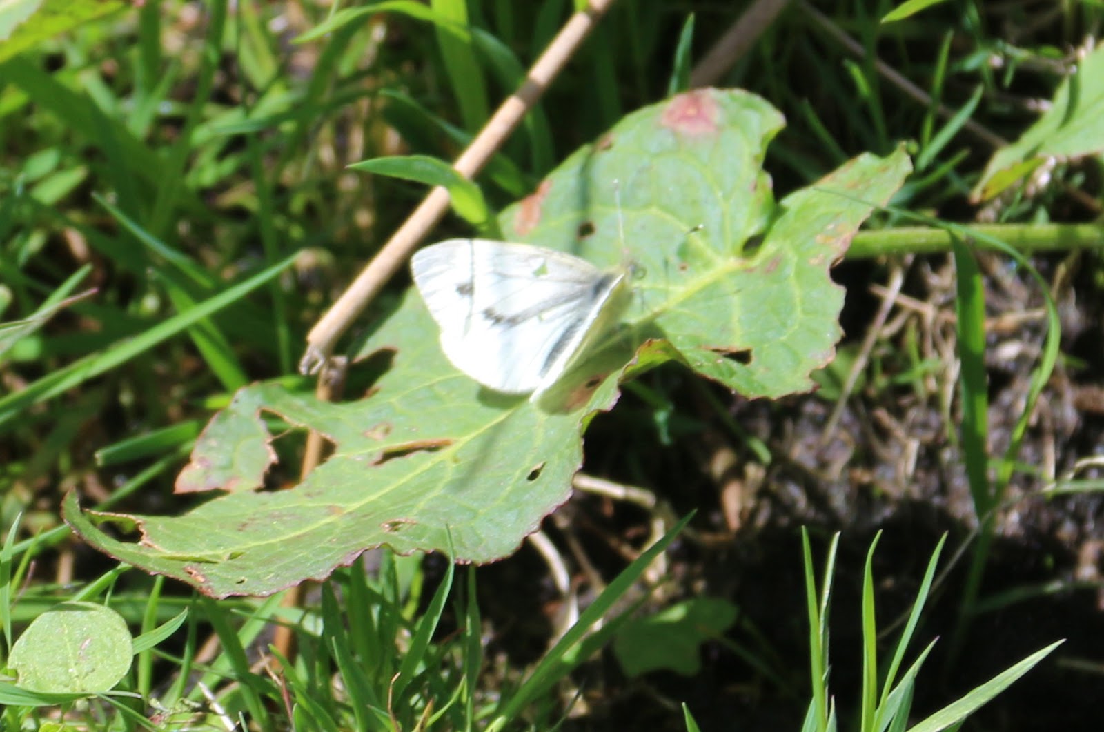 |
| A Small White butterfly, the only type flying around as we walked. This one is a male and he gave me a hard time trying to get him in focus. |
 |
| Lousewort (Pedicularis sylvatica). But the name doesn't refer to a herbal cure for lice but the belief that the damp places in which it grows, cause the cattle to be infested with lice and liver flukes. It's an interesting little plant with attractive fern like leaves and described as being hemi-parasitic. This means it lacks a fully developed root system and forms connections with another plant, from which it obtains some or all of its water and minerals. But it does have chlorophyll and produces its own food by photosynthesis as per normal. |
 |
| Walking up the side of Twelve Men's Moor, you soon notice that the area is littered with hut circles. You can make out 5 or 6 in this photograph. In days gone by, this was a very populated place. |
 |
| Looking north-ish towards Sharp Tor and a nicely patterned sky. Also patterned are the sides of Sharp Tor, patterned with the furrows of mediaeval field systems. These are more visible when the sun is low enough to cast shadows across them. |
 |
| The jumble of granite waste tumbling down from the Cheesewring Quarry. |
 |
| Just Larch. |
No comments:
Post a Comment